
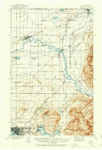
~ Sumas WA topo map, 1:62500 scale, 15 X 15 Minute, Historical, 1906, updated 1958
Sumas, Washington, USGS topographic map dated 1906.
Includes geographic coordinates (latitude and longitude). This topographic map is suitable for hiking, camping, and exploring, or framing it as a wall map.
Printed on-demand using high resolution imagery, on heavy weight and acid free paper, or alternatively on a variety of synthetic materials.
Topos available on paper, Waterproof, Poly, or Tyvek. Usually shipping rolled, unless combined with other folded maps in one order.
- Product Number: USGS-5687139
- Free digital map download (high-resolution, GeoPDF): Sumas, Washington (file size: 7 MB)
- Map Size: please refer to the dimensions of the GeoPDF map above
- Weight (paper map): ca. 55 grams
- Map Type: POD USGS Topographic Map
- Map Series: HTMC
- Map Verison: Historical
- Cell ID: 56998
- Scan ID: 244107
- Imprint Year: 1958
- Survey Year: 1906
- Datum: Unstated
- Map Projection: Polyconic
- Map published by United States Geological Survey
- Keywords: Overedge with No Adjacent Map
- Map Language: English
- Scanner Resolution: 600 dpi
- Map Cell Name: Lynden
- Grid size: 15 X 15 Minute
- Date on map: 1906
- Map Scale: 1:62500
- Geographical region: Washington, United States
Neighboring Maps:
All neighboring USGS topo maps are available for sale online at a variety of scales.
Spatial coverage:
Topo map Sumas, Washington, covers the geographical area associated the following places:
- Bellingham - Laurel - Larson Mill - Lawrence - Lynden - Forest Ridge - Goshen - Victor - Eureka - Northwood - Tenmile - Noon - Cedarville - Dewey - Dodson Mobile Home Park - Nooksack - Nugents Corner - Greenwood - Strandell - Hampton - Alabama Hill - Van Wyck - Washington Colony (historical) - Parkview - James Street Estates Mobile Home Park - Everson Mobile Home Estates - Roosevelt - Mill Wheel Mobile Home Park - Wahl - Royal Coachman Mobile Estates - Clearbrook - Silver Beach - Bakerview Mobile Estates - Everson - Agate Bay
- Map Area ID: AREA4948.75-122.5-122.25
- Northwest corner Lat/Long code: USGSNW49-122.5
- Northeast corner Lat/Long code: USGSNE49-122.25
- Southwest corner Lat/Long code: USGSSW48.75-122.5
- Southeast corner Lat/Long code: USGSSE48.75-122.25
- Northern map edge Latitude: 49
- Southern map edge Latitude: 48.75
- Western map edge Longitude: -122.5
- Eastern map edge Longitude: -122.25


