
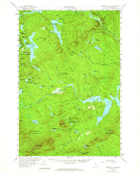
~ Penobscot Lake ME topo map, 1:62500 scale, 15 X 15 Minute, Historical, 1956, updated 1964
Penobscot Lake, Maine, USGS topographic map dated 1956.
Includes geographic coordinates (latitude and longitude). This topographic map is suitable for hiking, camping, and exploring, or framing it as a wall map.
Printed on-demand using high resolution imagery, on heavy weight and acid free paper, or alternatively on a variety of synthetic materials.
Topos available on paper, Waterproof, Poly, or Tyvek. Usually shipping rolled, unless combined with other folded maps in one order.
- Product Number: USGS-5684887
- Free digital map download (high-resolution, GeoPDF): Penobscot Lake, Maine (file size: 8 MB)
- Map Size: please refer to the dimensions of the GeoPDF map above
- Weight (paper map): ca. 55 grams
- Map Type: POD USGS Topographic Map
- Map Series: HTMC
- Map Verison: Historical
- Cell ID: 60871
- Scan ID: 460735
- Imprint Year: 1964
- Woodland Tint: Yes
- Aerial Photo Year: 1956
- Field Check Year: 1956
- Datum: NAD27
- Map Projection: Polyconic
- Map published by United States Geological Survey
- Map Language: English
- Scanner Resolution: 600 dpi
- Map Cell Name: Penobscot Lake
- Grid size: 15 X 15 Minute
- Date on map: 1956
- Map Scale: 1:62500
- Geographical region: Maine, United States
Neighboring Maps:
All neighboring USGS topo maps are available for sale online at a variety of scales.
Spatial coverage:
Topo map Penobscot Lake, Maine, covers the geographical area associated the following places:
- Beaver Pond - Cunningham Pond - Ironbound Pond - Clearwater Pond - Welman Pond - Spencer Brook - Spaulding Pond - Penobscot Brook - Bald Mountain Trail - Penobscot Lake Dam - Sears Pond - Trickey Bluffs - Mud Brook - Mary Petuche Pond - Ironbound Mountain - Little Fish Ponds - Deadwater Brook - Dole Brook Township - Boundary Bald Mountain - Long Pond Dam - Dingley Pond - Long Pond - Mullen Brook - Upper Dingley Pond - Cunningham Brook - White Deer Pond - Hutch Pond - Little Dingley Pond - Fitzgerald Pond - Lizzies Bog - Alder Brook - Canada Falls Lake - Cheney Pond - Little Fish Pond - Comstock Township - Trickey Ponds - Rattling Brook - Penobscot Lake - Jones Pond - Township of Bald Mountain - Duncan Pond - Hill Pond - Green Mountain - Little Lane Pond - Little Penobscot Brook - Bog Brook - Lane Pond - Dority Pond - Wounded Deer Pond - Big Grenier Pond - Pittston Academy Grant - Dubois Pond - Foley Pond - Bald Mountain Township T4 R3 - Hale Brook - Alder Brook Township - Fish Brook - Little Foley Pond - Comstock Mountain - Alder Pond - Hale Pond - Lewiston Pond - Hammond Township
- Map Area ID: AREA4645.75-70.25-70
- Northwest corner Lat/Long code: USGSNW46-70.25
- Northeast corner Lat/Long code: USGSNE46-70
- Southwest corner Lat/Long code: USGSSW45.75-70.25
- Southeast corner Lat/Long code: USGSSE45.75-70
- Northern map edge Latitude: 46
- Southern map edge Latitude: 45.75
- Western map edge Longitude: -70.25
- Eastern map edge Longitude: -70


