
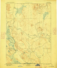
~ Klamath OR topo map, 1:250000 scale, 1 X 1 Degree, Historical, 1894, updated 1909
Klamath, Oregon, USGS topographic map dated 1894.
Includes geographic coordinates (latitude and longitude). This topographic map is suitable for hiking, camping, and exploring, or framing it as a wall map.
Printed on-demand using high resolution imagery, on heavy weight and acid free paper, or alternatively on a variety of synthetic materials.
Topos available on paper, Waterproof, Poly, or Tyvek. Usually shipping rolled, unless combined with other folded maps in one order.
- Product Number: USGS-5680643
- Free digital map download (high-resolution, GeoPDF): Klamath, Oregon (file size: 6 MB)
- Map Size: please refer to the dimensions of the GeoPDF map above
- Weight (paper map): ca. 55 grams
- Map Type: POD USGS Topographic Map
- Map Series: HTMC
- Map Verison: Historical
- Cell ID: 322295
- Scan ID: 283337
- Imprint Year: 1909
- Survey Year: 1887
- Datum: Unstated
- Map Projection: Unstated
- Map published by United States Geological Survey
- Map Language: English
- Scanner Resolution: 600 dpi
- Map Cell Name: Klamath Falls W
- Grid size: 1 X 1 Degree
- Date on map: 1894
- Map Scale: 1:250000
- Geographical region: Oregon, United States
Neighboring Maps:
All neighboring USGS topo maps are available for sale online at a variety of scales.
Spatial coverage:
Topo map Klamath, Oregon, covers the geographical area associated the following places:
- Langell Valley - Shady Pine - West Klamath (historical) - Keno - Malone - Malin - Pelican City - Klamath Falls - Bonanza - Olene - White Lake City (historical) - Bly - Fort Klamath - Midland - Plevna (historical) - Tule Lake (historical) - Falcon Heights - Haynesville - Dairy - Hager - Merganser (historical) - Merrill - Stewart Lenox - Terminal City - Altamont - Modoc Point - Chiloquin - Bedfield (historical) - Hot Springs - Henley - Fairhaven - Hildebrand - Pine Grove - Lorella - Kirk - Barkley (historical) - Worden - Klamath Agency - Sprague River - Yonna - Algoma - Beatty
- Map Area ID: AREA4342-122-121
- Northwest corner Lat/Long code: USGSNW43-122
- Northeast corner Lat/Long code: USGSNE43-121
- Southwest corner Lat/Long code: USGSSW42-122
- Southeast corner Lat/Long code: USGSSE42-121
- Northern map edge Latitude: 43
- Southern map edge Latitude: 42
- Western map edge Longitude: -122
- Eastern map edge Longitude: -121


