
~ Ashland OR topo map, 1:250000 scale, 1 X 1 Degree, Historical, 1891
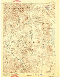
Ashland, Oregon, USGS topographic map dated 1891.
Includes geographic coordinates (latitude and longitude). This topographic map is suitable for hiking, camping, and exploring, or framing it as a wall map.
Printed on-demand using high resolution imagery, on heavy weight and acid free paper, or alternatively on a variety of synthetic materials.
Topos available on paper, Waterproof, Poly, or Tyvek. Usually shipping rolled, unless combined with other folded maps in one order.
- Product Number: USGS-5680611
- Free digital map download (high-resolution, GeoPDF): Ashland, Oregon (file size: 9 MB)
- Map Size: please refer to the dimensions of the GeoPDF map above
- Weight (paper map): ca. 55 grams
- Map Type: POD USGS Topographic Map
- Map Series: HTMC
- Map Verison: Historical
- Cell ID: 322296
- Scan ID: 283286
- Survey Year: 1887
- Datum: Unstated
- Map Projection: Unstated
- Map published by United States Geological Survey
- Map Language: English
- Scanner Resolution: 600 dpi
- Map Cell Name: Medford E
- Grid size: 1 X 1 Degree
- Date on map: 1891
- Map Scale: 1:250000
- Geographical region: Oregon, United States
Neighboring Maps:
All neighboring USGS topo maps are available for sale online at a variety of scales.
Spatial coverage:
Topo map Ashland, Oregon, covers the geographical area associated the following places:
- Trail - McLeod - Lake of the Woods - Prospect - Central Point - Rogue Elk - Chase (historical) - Mountain View - Cole - Eagle Point - Talent - Sams Valley - Wellen (historical) - Tolo - Potter Mill (historical) - Lincoln - Buckhorn Springs - Ashland - Bitter Lick - Rocky Point - Lake Creek - Climax - Pokegama (historical) - Recreation (historical) - Four Corners - White City - Beagle - Spikenard (historical) - Asbestos (historical) - Colestin - Barron (historical) - Derby (historical) - Brownsboro - Jacksonville - Tiller - Perrydale (historical) - Bybee Corner - Butte Falls - Crystal (historical) - Etna (historical) - Pinehurst - Cascade Gorge - Persist (historical) - Dudley (historical) - Clover Station (historical) - Table Rock - Buncom - Edsalla (historical) - Seven Oaks - Shady Cove - Medford - Union Creek - Phoenix - Drew - Mountain View (historical)
- Map Area ID: AREA4342-123-122
- Northwest corner Lat/Long code: USGSNW43-123
- Northeast corner Lat/Long code: USGSNE43-122
- Southwest corner Lat/Long code: USGSSW42-123
- Southeast corner Lat/Long code: USGSSE42-122
- Northern map edge Latitude: 43
- Southern map edge Latitude: 42
- Western map edge Longitude: -123
- Eastern map edge Longitude: -122


