
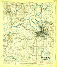
~ Montgomery AL topo map, 1:62500 scale, 15 X 15 Minute, Historical, 1930
Montgomery, Alabama, USGS topographic map dated 1930.
Includes geographic coordinates (latitude and longitude). This topographic map is suitable for hiking, camping, and exploring, or framing it as a wall map.
Printed on-demand using high resolution imagery, on heavy weight and acid free paper, or alternatively on a variety of synthetic materials.
Topos available on paper, Waterproof, Poly, or Tyvek. Usually shipping rolled, unless combined with other folded maps in one order.
- Product Number: USGS-5679132
- Free digital map download (high-resolution, GeoPDF): Montgomery, Alabama (file size: 8 MB)
- Map Size: please refer to the dimensions of the GeoPDF map above
- Weight (paper map): ca. 55 grams
- Map Type: POD USGS Topographic Map
- Map Series: HTMC
- Map Verison: Historical
- Cell ID: 57815
- Scan ID: 305642
- Survey Year: 1927
- Datum: NAD
- Map Projection: Polyconic
- Map published by United States Geological Survey
- Map Language: English
- Scanner Resolution: 600 dpi
- Map Cell Name: Montgomery
- Grid size: 15 X 15 Minute
- Date on map: 1930
- Map Scale: 1:62500
- Geographical region: Alabama, United States
Neighboring Maps:
All neighboring USGS topo maps are available for sale online at a variety of scales.
Spatial coverage:
Topo map Montgomery, Alabama, covers the geographical area associated the following places:
- Pecan Grove Estates - Fairview - Lakeview Heights - Edgemont Heights - Southlawn - Governors Estates - Cleveland Meadows - Washington Hill - Overlook - Fays - Rose Hill - Wildwood - Cross Creek - W C Rices Trailer Park - Flatwood - Windwood - Country Estates - Onoqua (historical) - King Arthur Manor - Prattville Junction - Elsmeade - Melmar - Hillcrest - Rosemont Heights - Normandale - Pine Brook Estates - Lynndale - Hillwood West - Country Club Estates - Open Acres - Dannley Pines - Forest Hills - Gladlane Estates - Seth Johnson Estates - Spring Park - Western Hills - Five Points - Morningview - Clubview Estates - Bellemeade - Gay Meadows - Park Manor - Hunter - North Pass - Kingswood - Lagos del Sol - Wiley - Prairie View Estates - Powelldale - Autauga (historical) - Valley Whispers - North Montgomery - Smithboro (historical) - Greater Washington Park - McGehees - Southern Meadows - Stones - Garden Square - Brewer Estates - Woodcrest Estates - Gibbs Village - McGehee Estates - Village West - Westgate - Cedar Point - Carver Park - Brentwood - Millbrook - Rosemond Estates - Upper Kingston - Grovewood - Westview Gardens - Maxwell Heights - Cloverdale - Jacksons Lake - Hunting Ridge - Steiner - Hillwood - Selbrook - Chisholm - Woodley Park - Sunset Park Estates - Mayfair - Young Forte Village - Memorial Heights - Wareingwood - Mobile Heights - King Hill - Washington (historical) - Brookview Manor - Langford Mobile Home Park - Lynwood Terrace - Prattville - Oak Park - West End - Sunshine Acres - Twin Gates Estates - Boylston - Highland Gardens - Sherwood
- Map Area ID: AREA32.532.25-86.5-86.25
- Northwest corner Lat/Long code: USGSNW32.5-86.5
- Northeast corner Lat/Long code: USGSNE32.5-86.25
- Southwest corner Lat/Long code: USGSSW32.25-86.5
- Southeast corner Lat/Long code: USGSSE32.25-86.25
- Northern map edge Latitude: 32.5
- Southern map edge Latitude: 32.25
- Western map edge Longitude: -86.5
- Eastern map edge Longitude: -86.25


