
~ Nabesna A 2 AK topo map, 1:63360 scale, 15 X 15 Minute, Historical, 1960, updated 1966
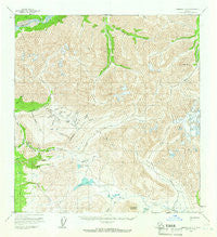
Nabesna A 2, Alaska, USGS topographic map dated 1960.
Includes geographic coordinates (latitude and longitude). This topographic map is suitable for hiking, camping, and exploring, or framing it as a wall map.
Printed on-demand using high resolution imagery, on heavy weight and acid free paper, or alternatively on a variety of synthetic materials.
Topos available on paper, Waterproof, Poly, or Tyvek. Usually shipping rolled, unless combined with other folded maps in one order.
- Product Number: USGS-5670536
- Free digital map download (high-resolution, GeoPDF): Nabesna A 2, Alaska (file size: 18 MB)
- Map Size: please refer to the dimensions of the GeoPDF map above
- Weight (paper map): ca. 55 grams
- Map Type: POD USGS Topographic Map
- Map Series: HTMC
- Map Verison: Historical
- Cell ID: 58222
- Scan ID: 357898
- Imprint Year: 1966
- Woodland Tint: Yes
- Aerial Photo Year: 1957
- Datum: NAD27
- Map Projection: Universal Transverse Mercator
- Map published by United States Geological Survey
- Map Language: English
- Scanner Resolution: 600 dpi
- Map Cell Name: Nabesna A-2
- Grid size: 15 X 15 Minute
- Date on map: 1960
- Map Scale: 1:63360
- Geographical region: Alaska, United States
Neighboring Maps:
All neighboring USGS topo maps are available for sale online at a variety of scales.
Spatial coverage:
Topo map Nabesna A 2, Alaska, covers the geographical area associated the following places:
- Big Eldorado Creek - Erickson Gulch - Nutzotin Mountains - Glacier Creek - Alder Gulch - Willow Creek - Skookum Creek - Funshoot Mountain - Little Beaver Lake - Simons Trail - Snow Gulch - Flat Creek - Chicken Creek - Poorman Creek - Two by Four Creek - Little Eldorado Creek - Needle Peak - Gold Run Creek - Pensive Pup - James Creek - Bonanza Creek - California Creek - Beaver Creek - Toby Creek - Alder Lakes - Discovery Pup - Bug Gulch - Pensire Pup - Caribou Pass - Carl Creek - Bonanza - Coarse Money Creek - Rhyolite Creek - Beaver Lake - Salt Creek - Canyon Creek - Gold Hill - Sargent Creek - Paulson Creek
- Map Area ID: AREA62.2562-142-141.5
- Northwest corner Lat/Long code: USGSNW62.25-142
- Northeast corner Lat/Long code: USGSNE62.25-141.5
- Southwest corner Lat/Long code: USGSSW62-142
- Southeast corner Lat/Long code: USGSSE62-141.5
- Northern map edge Latitude: 62.25
- Southern map edge Latitude: 62
- Western map edge Longitude: -142
- Eastern map edge Longitude: -141.5


