
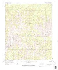
~ Livengood B 6 AK topo map, 1:63360 scale, 15 X 15 Minute, Historical, 1956, updated 1973
Livengood B 6, Alaska, USGS topographic map dated 1956.
Includes geographic coordinates (latitude and longitude). This topographic map is suitable for hiking, camping, and exploring, or framing it as a wall map.
Printed on-demand using high resolution imagery, on heavy weight and acid free paper, or alternatively on a variety of synthetic materials.
Topos available on paper, Waterproof, Poly, or Tyvek. Usually shipping rolled, unless combined with other folded maps in one order.
- Product Number: USGS-5669024
- Free digital map download (high-resolution, GeoPDF): Livengood B 6, Alaska (file size: 16 MB)
- Map Size: please refer to the dimensions of the GeoPDF map above
- Weight (paper map): ca. 55 grams
- Map Type: POD USGS Topographic Map
- Map Series: HTMC
- Map Verison: Historical
- Cell ID: 56798
- Scan ID: 357120
- Imprint Year: 1973
- Woodland Tint: Yes
- Visual Version Number: 1
- Aerial Photo Year: 1953
- Edit Year: 1972
- Datum: NAD27
- Map Projection: Universal Transverse Mercator
- Map published by United States Geological Survey
- Map Language: English
- Scanner Resolution: 600 dpi
- Map Cell Name: Livengood B-6
- Grid size: 15 X 15 Minute
- Date on map: 1956
- Map Scale: 1:63360
- Geographical region: Alaska, United States
Neighboring Maps:
All neighboring USGS topo maps are available for sale online at a variety of scales.
Spatial coverage:
Topo map Livengood B 6, Alaska, covers the geographical area associated the following places:
- Miller Creek - Dawson Creek - Eldorado Creek - Bear Creek - Sluicebox Creek - Forty-seven Gulch - Flat Creek - Gunnison Creek - Green Gulch - Blizzard Creek - Quail Creek Airport - Quail Creek - Wolverine Mountain - Nugget Creek - Caribou Creek - Teton Creek - Thirteen Pup - Ninety-two Hunter Creek - Willow Creek - Lynx Peak - Bonanza Creek - South Fork Quail Creek - Grouse Creek - Orphan Creek - Rampart Census Designated Place - Sawtooth Mountain - Texas Creek - Ohio Creek - Gazzam Creek
- Map Area ID: AREA65.565.25-150-149.5
- Northwest corner Lat/Long code: USGSNW65.5-150
- Northeast corner Lat/Long code: USGSNE65.5-149.5
- Southwest corner Lat/Long code: USGSSW65.25-150
- Southeast corner Lat/Long code: USGSSE65.25-149.5
- Northern map edge Latitude: 65.5
- Southern map edge Latitude: 65.25
- Western map edge Longitude: -150
- Eastern map edge Longitude: -149.5


