
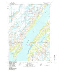
~ Anchorage A 3 AK topo map, 1:63360 scale, 15 X 15 Minute, Historical, 1960, updated 1987
Anchorage A 3, Alaska, USGS topographic map dated 1960.
Includes geographic coordinates (latitude and longitude). This topographic map is suitable for hiking, camping, and exploring, or framing it as a wall map.
Printed on-demand using high resolution imagery, on heavy weight and acid free paper, or alternatively on a variety of synthetic materials.
Topos available on paper, Waterproof, Poly, or Tyvek. Usually shipping rolled, unless combined with other folded maps in one order.
- Product Number: USGS-5662632
- Free digital map download (high-resolution, GeoPDF): Anchorage A 3, Alaska (file size: 14 MB)
- Map Size: please refer to the dimensions of the GeoPDF map above
- Weight (paper map): ca. 55 grams
- Map Type: POD USGS Topographic Map
- Map Series: HTMC
- Map Verison: Historical
- Cell ID: 50545
- Scan ID: 361714
- Imprint Year: 1987
- Woodland Tint: Yes
- Aerial Photo Year: 1979
- Datum: NAD27
- Map Projection: Universal Transverse Mercator
- Map published by United States Geological Survey
- Map Language: English
- Scanner Resolution: 600 dpi
- Map Cell Name: Anchorage A-3
- Grid size: 15 X 15 Minute
- Date on map: 1960
- Map Scale: 1:63360
- Geographical region: Alaska, United States
Neighboring Maps:
All neighboring USGS topo maps are available for sale online at a variety of scales.
Spatial coverage:
Topo map Anchorage A 3, Alaska, covers the geographical area associated the following places:
- Barry Glacier - Yale Arm College Fiord - Williams Glacier - Mount Emerson - Pakenham Point - Lafayette Glacier - Holyoke Glacier - Vassar Glacier - Coghill River - College Fiord - Harvard Arm - Barnard Glacier - Mount Coville - Coghill Point - College Point - Amherst Glacier - Coghill Lake - Wellesley Glacier - Mount Curtis - Coxe Glacier
- Map Area ID: AREA61.2561-148.125-147.75
- Northwest corner Lat/Long code: USGSNW61.25-148.125
- Northeast corner Lat/Long code: USGSNE61.25-147.75
- Southwest corner Lat/Long code: USGSSW61-148.125
- Southeast corner Lat/Long code: USGSSE61-147.75
- Northern map edge Latitude: 61.25
- Southern map edge Latitude: 61
- Western map edge Longitude: -148.125
- Eastern map edge Longitude: -147.75


