
~ Seguam AK topo map, 1:250000 scale, 1 X 2 Degree, Historical, 1958, updated 1984
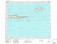
Seguam, Alaska, USGS topographic map dated 1958.
Includes geographic coordinates (latitude and longitude). This topographic map is suitable for hiking, camping, and exploring, or framing it as a wall map.
Printed on-demand using high resolution imagery, on heavy weight and acid free paper, or alternatively on a variety of synthetic materials.
Topos available on paper, Waterproof, Poly, or Tyvek. Usually shipping rolled, unless combined with other folded maps in one order.
- Product Number: USGS-5661878
- Free digital map download (high-resolution, GeoPDF): Seguam, Alaska (file size: 25 MB)
- Map Size: please refer to the dimensions of the GeoPDF map above
- Weight (paper map): ca. 55 grams
- Map Type: POD USGS Topographic Map
- Map Series: HTMC
- Map Verison: Historical
- Cell ID: 69022
- Scan ID: 361397
- Imprint Year: 1984
- Edit Year: 1983
- Survey Year: 1958
- Datum: NAD27
- Map Projection: Universal Transverse Mercator
- Map published by United States Geological Survey
- Map Language: English
- Scanner Resolution: 600 dpi
- Map Cell Name: Seguam
- Grid size: 1 X 2 Degree
- Date on map: 1958
- Map Scale: 1:250000
- Geographical region: Alaska, United States
Neighboring Maps:
All neighboring USGS topo maps are available for sale online at a variety of scales.
Spatial coverage:
Topo map Seguam, Alaska, covers the geographical area associated the following places:
- Sxulax - Amligim-kangayuu - Iilas - Suuksax - Kagalusux - Iiguyaaglix - Gudagis - Chaamlagan Yaaga - Tunulagalux - Agligadak Island - Qagaagix Kiiguusix - Haniidax - Qigaagix Usax - Chngadigax - Haystack Rock - Haanugiidax - Qumdaga - Tinas - Tanadak Island - Hanitunam Kiiguucha - Haanugim-yangis - Agaamaga - Asxanung - Kagalusum Hachan Tanangis - Quchiix - Silaxagis - Atuung Aagayuuxtas - Chugiinulux - Yasis Adangan Yaaga - Pinnacle Rock - Changilax - Qaygisux - Uhmaaga - Uchiing Hasangis - Tanagayugim Hidaluu - Klochkof Rock - Qigaagix Qaxchxix - Chagazudax - Tinas Kadaa - Lava Point - Aagumchiidalix - Hiiyukatux - Ululax - Qalgizax - Saahmim-tatuu - Chalux - Naagix Qaxchxix - Naagix Kiiguusix - Qusugiinax - Qugdugiidax - Saddleridge Point - Uzamkux - Uchiing - Hasxugiidax - Kaalam-tutucha - Chukaalux - Asagam Udaa - Qaluga - Hungry Bay - Chyaguulax - Qagangiigux - Chaamlaga - Aguulux - Hiitxagiidam-qagangan Udaa - Chugumanax - Hadas - Sviechnikof Harbor - Hadgiilux - Ungluzuudax - Sitaadaga - Hadgiilum Adangan Yaaga - Uyaxsax - Turf Point - Kunalisxux - Achiix - Chalugas Bay - Agamsax - Lava Cove - Agugnadigax - Qagangiiguudax - Nahmagix - Asxaadaliilux - Cape Idalug - Amlia Island - Chyaguulam Adangan Yaaga - Kadaangim Ungluu - Chankusix - Ugixaga - Aleutian Islands - Hadatxus - Amunaxagin Suluga - Akuudgix - Qasilasix - Quxsus - Pyre Peak - Amlagim Qigaagix Angtaa - Chumliisim Tatuu - Inqix - Suluga - Kadax
- Map Area ID: AREA52.551.5-174-172
- Northwest corner Lat/Long code: USGSNW52.5-174
- Northeast corner Lat/Long code: USGSNE52.5-172
- Southwest corner Lat/Long code: USGSSW51.5-174
- Southeast corner Lat/Long code: USGSSE51.5-172
- Northern map edge Latitude: 52.5
- Southern map edge Latitude: 51.5
- Western map edge Longitude: -174
- Eastern map edge Longitude: -172


