
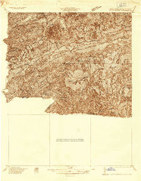
~ Mount Rogers VA topo map, 1:48000 scale, 15 X 15 Minute, Historical, 1935
Mount Rogers, Virginia, USGS topographic map dated 1935.
Includes geographic coordinates (latitude and longitude). This topographic map is suitable for hiking, camping, and exploring, or framing it as a wall map.
Printed on-demand using high resolution imagery, on heavy weight and acid free paper, or alternatively on a variety of synthetic materials.
Topos available on paper, Waterproof, Poly, or Tyvek. Usually shipping rolled, unless combined with other folded maps in one order.
- Product Number: USGS-5659826
- Free digital map download (high-resolution, GeoPDF): Mount Rogers, Virginia (file size: 14 MB)
- Map Size: please refer to the dimensions of the GeoPDF map above
- Weight (paper map): ca. 55 grams
- Map Type: POD USGS Topographic Map
- Map Series: HTMC
- Map Verison: Historical
- Cell ID: 58105
- Scan ID: 187720
- Survey Year: 1935
- Datum: NAD27
- Map Projection: Polyconic
- Advance: Yes
- Map published by United States Geological Survey
- Keywords: Nonstandard Press Run; Overedge
- Map Language: English
- Scanner Resolution: 600 dpi
- Map Cell Name: Mount Rogers
- Grid size: 15 X 15 Minute
- Date on map: 1935
- Map Scale: 1:48000
- Geographical region: Virginia, United States
Neighboring Maps:
All neighboring USGS topo maps are available for sale online at a variety of scales.
Spatial coverage:
Topo map Mount Rogers, Virginia, covers the geographical area associated the following places:
- Creek Junction - Listening Rock - Green Cove - Loves Mill - Big Hill - Sugar Creek - Whitetop - Grayson - Murrayfield - Masada - Taylors Valley - Dry Fork - Stony Battery - Widener Valley - Nella - Tuckerdale - Konnarock - Azen - Apple Grove - Brandon - Friendship - Flatwood
- Map Area ID: AREA36.7536.5-81.75-81.5
- Northwest corner Lat/Long code: USGSNW36.75-81.75
- Northeast corner Lat/Long code: USGSNE36.75-81.5
- Southwest corner Lat/Long code: USGSSW36.5-81.75
- Southeast corner Lat/Long code: USGSSE36.5-81.5
- Northern map edge Latitude: 36.75
- Southern map edge Latitude: 36.5
- Western map edge Longitude: -81.75
- Eastern map edge Longitude: -81.5


