
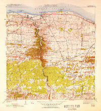
~ Camuy PR topo map, 1:30000 scale, 7.5 X 7.5 Minute, Historical, 1942, updated 1952
Camuy, Puerto Rico, USGS topographic map dated 1942.
Includes geographic coordinates (latitude and longitude). This topographic map is suitable for hiking, camping, and exploring, or framing it as a wall map.
Printed on-demand using high resolution imagery, on heavy weight and acid free paper, or alternatively on a variety of synthetic materials.
Topos available on paper, Waterproof, Poly, or Tyvek. Usually shipping rolled, unless combined with other folded maps in one order.
- Product Number: USGS-5655186
- Free digital map download (high-resolution, GeoPDF): Camuy, Puerto Rico (file size: 10 MB)
- Map Size: please refer to the dimensions of the GeoPDF map above
- Weight (paper map): ca. 55 grams
- Map Type: POD USGS Topographic Map
- Map Series: HTMC
- Map Verison: Historical
- Cell ID: 69536
- Scan ID: 362359
- Imprint Year: 1952
- Woodland Tint: Yes
- Edit Year: 1949
- Survey Year: 1938
- Datum: Puerto Rico
- Map Projection: Polyconic
- Map published by United States Geological Survey
- Map Language: English
- Scanner Resolution: 600 dpi
- Map Cell Name: Camuy
- Grid size: 7.5 X 7.5 Minute
- Date on map: 1942
- Map Scale: 1:30000
- Geographical region: Puerto Rico, United States
Neighboring Maps:
All neighboring USGS topo maps are available for sale online at a variety of scales.
Spatial coverage:
Topo map Camuy, Puerto Rico, covers the geographical area associated the following places:
- El Saco - Rafael González Comunidad - Barriada Clan - Carrizales Comunidad - La Pica - Sector Alvares - Vistas de Camuy - Hatillo Zona Urbana - Alcantavilla - Radioville - Membrillo - Alta Monte - Las Cunetas - Pueblo Nuevo - Jardines de Arecibo - Camuy Zona Urbana - Rafael Capó Comunidad - Sector Pena Militar - Corcovado - Sector Puente Salsa - Rafael Gonzalez - Alianza - Comunidad Santa Rosa - Camuy - Mar Azul - Linda Vista - Hatillo - Barriada Aguilar - Palomar - Alianza Comunidad - Vistas de Camuy II - El Pajuil - Punta Brava - Maracayo - Hatillo Del Mar - Lechuga - Villa Los Pinos - Corcovado Comunidad - San Jose - Barranca - Villa del Carmen - Colinas de Hatillo - La Cuesta - Boulvearda Pena - Paloma - Del Carmen - Residencial Ramon Adames - Extension del Carmen - Residencial Ruiz Miranda - Estancias Hatillo - Cuatro Calles - Carrizales - Rafael Capo - Matojillo
- Map Area ID: AREA18.518.375-66.875-66.75
- Northwest corner Lat/Long code: USGSNW18.5-66.875
- Northeast corner Lat/Long code: USGSNE18.5-66.75
- Southwest corner Lat/Long code: USGSSW18.375-66.875
- Southeast corner Lat/Long code: USGSSE18.375-66.75
- Northern map edge Latitude: 18.5
- Southern map edge Latitude: 18.375
- Western map edge Longitude: -66.875
- Eastern map edge Longitude: -66.75


