
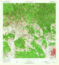
~ Penuelas PR topo map, 1:20000 scale, 7.5 X 7.5 Minute, Historical, 1964, updated 1966
Penuelas, Puerto Rico, USGS topographic map dated 1964.
Includes geographic coordinates (latitude and longitude). This topographic map is suitable for hiking, camping, and exploring, or framing it as a wall map.
Printed on-demand using high resolution imagery, on heavy weight and acid free paper, or alternatively on a variety of synthetic materials.
Topos available on paper, Waterproof, Poly, or Tyvek. Usually shipping rolled, unless combined with other folded maps in one order.
- Product Number: USGS-5654894
- Free digital map download (high-resolution, GeoPDF): Penuelas, Puerto Rico (file size: 25 MB)
- Map Size: please refer to the dimensions of the GeoPDF map above
- Weight (paper map): ca. 55 grams
- Map Type: POD USGS Topographic Map
- Map Series: HTMC
- Map Verison: Historical
- Cell ID: 34746
- Scan ID: 362187
- Imprint Year: 1966
- Woodland Tint: Yes
- Aerial Photo Year: 1941
- Edit Year: 1964
- Survey Year: 1943
- Datum: Puerto Rico
- Map Projection: Polyconic
- Map published by United States Geological Survey
- Map Language: English
- Scanner Resolution: 600 dpi
- Map Cell Name: Penuelas
- Grid size: 7.5 X 7.5 Minute
- Date on map: 1964
- Map Scale: 1:20000
- Geographical region: Puerto Rico, United States
Neighboring Maps:
All neighboring USGS topo maps are available for sale online at a variety of scales.
Spatial coverage:
Topo map Penuelas, Puerto Rico, covers the geographical area associated the following places:
- Magueyes - Penuelas Valley - Marueño - Hacienda Molina - Santo Domingo Comunidad - Seboruco - Clausells - Reparto Valle Alto - Rio Canas - Quebrada del Agua Comunidad - Hacienda Josefa - Kennedy - Sector Ruberte - Corral Viejo - Las Delicias - Peñuelas Zona Urbana - Jaguas - Sector La Loma - Rio Sol - Granada Hills - El Yerbo - Hacienda Esperanza - Tallaboa Alta - Pastillo - Comunidad Caracoles - Hacienda Batíz - Tallaboa Poniente - Corral Viejo Comunidad - El Madrigal - Morel Campos - Reparto Guaynes - Hacienda Burenes - Alturas de Penuelas - Guaypao - Peñuelas - Tibes Comunidad - Cuebas - Jardines de Penuelas - Riverside - Pastillo Cana - Tallaboa Alta Comunidad - San Antonio - Marueño Comunidad - Jardines del Caribe - Rucio - Hacienda Oliva - Baldorioty de Castro - Corozal
- Map Area ID: AREA18.12518-66.75-66.625
- Northwest corner Lat/Long code: USGSNW18.125-66.75
- Northeast corner Lat/Long code: USGSNE18.125-66.625
- Southwest corner Lat/Long code: USGSSW18-66.75
- Southeast corner Lat/Long code: USGSSE18-66.625
- Northern map edge Latitude: 18.125
- Southern map edge Latitude: 18
- Western map edge Longitude: -66.75
- Eastern map edge Longitude: -66.625


