
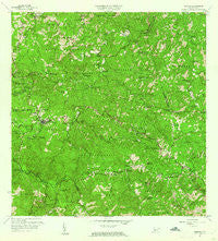
~ Maricao PR topo map, 1:20000 scale, 7.5 X 7.5 Minute, Historical, 1960, updated 1961
Maricao, Puerto Rico, USGS topographic map dated 1960.
Includes geographic coordinates (latitude and longitude). This topographic map is suitable for hiking, camping, and exploring, or framing it as a wall map.
Printed on-demand using high resolution imagery, on heavy weight and acid free paper, or alternatively on a variety of synthetic materials.
Topos available on paper, Waterproof, Poly, or Tyvek. Usually shipping rolled, unless combined with other folded maps in one order.
- Product Number: USGS-5654828
- Free digital map download (high-resolution, GeoPDF): Maricao, Puerto Rico (file size: 25 MB)
- Map Size: please refer to the dimensions of the GeoPDF map above
- Weight (paper map): ca. 55 grams
- Map Type: POD USGS Topographic Map
- Map Series: HTMC
- Map Verison: Historical
- Cell ID: 27685
- Scan ID: 362152
- Imprint Year: 1961
- Woodland Tint: Yes
- Aerial Photo Year: 1941
- Edit Year: 1960
- Field Check Year: 1943
- Datum: Puerto Rico
- Map Projection: Polyconic
- Map published by United States Geological Survey
- Map Language: English
- Scanner Resolution: 600 dpi
- Map Cell Name: Maricao
- Grid size: 7.5 X 7.5 Minute
- Date on map: 1960
- Map Scale: 1:20000
- Geographical region: Puerto Rico, United States
Neighboring Maps:
All neighboring USGS topo maps are available for sale online at a variety of scales.
Spatial coverage:
Topo map Maricao, Puerto Rico, covers the geographical area associated the following places:
- El Bosque - Hacienda Esperanza - Residencial Juan Ferrer - Maricao Zona Urbana - Hacienda Delicias - Hacienda La Vega - Hacienda Santa Rita - Pueblo Nuevo - Hacienda Josefa - Hacienda Teresa - Hacienda Balare - Maricao - Hacienda Candelaria - Francisco Serrano - Campamento Santana - Indiera Alta - Hacienda Constancia - Hacienda Llanada - Sector Pueblo Nuevo - Hacienda Buena Vista - Hacienda La Luisa - Hacienda Lealtad - Hacienda Manuela - Hacienda La Delfina - Hacienda San Antonio - Naranjales - Hacienda Santa Barbara (historical) - Hacienda Monserrate - Hacienda Ballester - Hacienda La Rosita - Hacienda Espino - Campamento Buena Vista - San Juan Bautista - Hacienda Santiago
- Map Area ID: AREA18.2518.125-67-66.875
- Northwest corner Lat/Long code: USGSNW18.25-67
- Northeast corner Lat/Long code: USGSNE18.25-66.875
- Southwest corner Lat/Long code: USGSSW18.125-67
- Southeast corner Lat/Long code: USGSSE18.125-66.875
- Northern map edge Latitude: 18.25
- Southern map edge Latitude: 18.125
- Western map edge Longitude: -67
- Eastern map edge Longitude: -66.875


