
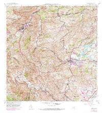
~ Comerio PR topo map, 1:20000 scale, 7.5 X 7.5 Minute, Historical, 1957, updated 1982
Comerio, Puerto Rico, USGS topographic map dated 1957.
Includes geographic coordinates (latitude and longitude). This topographic map is suitable for hiking, camping, and exploring, or framing it as a wall map.
Printed on-demand using high resolution imagery, on heavy weight and acid free paper, or alternatively on a variety of synthetic materials.
Topos available on paper, Waterproof, Poly, or Tyvek. Usually shipping rolled, unless combined with other folded maps in one order.
- Product Number: USGS-5654704
- Free digital map download (high-resolution, GeoPDF): Comerio, Puerto Rico (file size: 27 MB)
- Map Size: please refer to the dimensions of the GeoPDF map above
- Weight (paper map): ca. 55 grams
- Map Type: POD USGS Topographic Map
- Map Series: HTMC
- Map Verison: Historical
- Cell ID: 9753
- Scan ID: 362096
- Imprint Year: 1982
- Woodland Tint: Yes
- Photo Revision Year: 1982
- Aerial Photo Year: 1977
- Edit Year: 1982
- Field Check Year: 1943
- Datum: Puerto Rico
- Map Projection: Polyconic
- Map published by United States Geological Survey
- Map Language: English
- Scanner Resolution: 600 dpi
- Map Cell Name: Comerio
- Grid size: 7.5 X 7.5 Minute
- Date on map: 1957
- Map Scale: 1:20000
- Geographical region: Puerto Rico, United States
Neighboring Maps:
All neighboring USGS topo maps are available for sale online at a variety of scales.
Spatial coverage:
Topo map Comerio, Puerto Rico, covers the geographical area associated the following places:
- Sector Villa Brava - Toita - Rodríguez Hevia - Residencial Manuel Martorell - Santa Clara - Jardines de Villa del Carmen - Santa Clara Comunidad - Nogueras - Cidra - Parcelas La Milagrosa Comunidad - Minima La Plata - Freire - Bayamoncito - Comerío Zona Urbana - Residencial Prexedes Santiago - Residencial Jardines de Cidra - Sumidero - Parcelas Nuevas Comunidad - Comunidad Las Casitas - Sector Laso - Parcelas La Milagrosa - Gándara - Cidra Zona Urbana - Treasure Valley - Comunidad Gandara - Río Hondo - Fernandez - Parcelas Nuevas - Treasure Island Gardens - Escuela La Prieta - Robles - Piñas - Sector Santa Teresita - Comerío - Iglesia Virgen de la Providencia - Santa Clara - La Hacienda - La Plata - Rodríguez Hevia Comunidad - Sector Los Flores
- Map Area ID: AREA18.2518.125-66.25-66.125
- Northwest corner Lat/Long code: USGSNW18.25-66.25
- Northeast corner Lat/Long code: USGSNE18.25-66.125
- Southwest corner Lat/Long code: USGSSW18.125-66.25
- Southeast corner Lat/Long code: USGSSE18.125-66.125
- Northern map edge Latitude: 18.25
- Southern map edge Latitude: 18.125
- Western map edge Longitude: -66.25
- Eastern map edge Longitude: -66.125


