
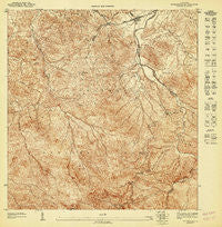
~ El Yunque NE PR topo map, 1:10000 scale, 3.75 X 3.75 Minute, Historical, 1947
El Yunque NE, Puerto Rico, USGS topographic map dated 1947.
Includes geographic coordinates (latitude and longitude). This topographic map is suitable for hiking, camping, and exploring, or framing it as a wall map.
Printed on-demand using high resolution imagery, on heavy weight and acid free paper, or alternatively on a variety of synthetic materials.
Topos available on paper, Waterproof, Poly, or Tyvek. Usually shipping rolled, unless combined with other folded maps in one order.
- Product Number: USGS-5654138
- Free digital map download (high-resolution, GeoPDF): El Yunque NE, Puerto Rico (file size: 24 MB)
- Map Size: please refer to the dimensions of the GeoPDF map above
- Weight (paper map): ca. 55 grams
- Map Type: POD USGS Topographic Map
- Map Series: HTMC
- Map Verison: Historical
- Cell ID: 156095
- Scan ID: 361988
- Survey Year: 1943
- Datum: Unstated
- Map Projection: Polyconic
- Preliminary map: Yes
- Map published by United States Geological Survey
- Map Language: Spanish
- Scanner Resolution: 600 dpi
- Map Cell Name: El Yunque NE
- Grid size: 3.75 X 3.75 Minute
- Date on map: 1947
- Map Scale: 1:10000
- Geographical region: Puerto Rico, United States
Neighboring Maps:
All neighboring USGS topo maps are available for sale online at a variety of scales.
Spatial coverage:
Topo map El Yunque NE, Puerto Rico, covers the geographical area associated the following places:
- Palmer - Mabí - Hato Candal - Palmer Comunidad - Campamento Zarzal - Las Tres T - Colinas del Yunque - Hato Candal Comunidad - Campamento de Niños - La Vega - Mameyes
- Map Area ID: AREA18.37518.3125-65.8125-65.75
- Northwest corner Lat/Long code: USGSNW18.375-65.8125
- Northeast corner Lat/Long code: USGSNE18.375-65.75
- Southwest corner Lat/Long code: USGSSW18.3125-65.8125
- Southeast corner Lat/Long code: USGSSE18.3125-65.75
- Northern map edge Latitude: 18.375
- Southern map edge Latitude: 18.3125
- Western map edge Longitude: -65.8125
- Eastern map edge Longitude: -65.75


