
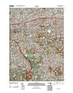
~ Newton MA topo map, 1:24000 scale, 7.5 X 7.5 Minute, Historical, 2012
Newton, Massachusetts, USGS topographic map dated 2012.
Includes geographic coordinates (latitude and longitude). This topographic map is suitable for hiking, camping, and exploring, or framing it as a wall map.
Printed on-demand using high resolution imagery, on heavy weight and acid free paper, or alternatively on a variety of synthetic materials.
Topos available on paper, Waterproof, Poly, or Tyvek. Usually shipping rolled, unless combined with other folded maps in one order.
- Product Number: USGS-5646211
- Free digital map download (high-resolution, GeoPDF): Newton, Massachusetts (file size: 24 MB)
- Map Size: please refer to the dimensions of the GeoPDF map above
- Weight (paper map): ca. 55 grams
- Map Type: POD USGS Topographic Map
- Map Series: US Topo
- Map Verison: Historical
- Cell ID: 32015
- Datum: North American Datum of 1983
- Map Projection: Transverse Mercator
- Map Cell Name: Newton
- Grid size: 7.5 X 7.5 Minute
- Date on map: 2012
- Map Scale: 1:24000
- Geographical region: Massachusetts, United States
Neighboring Maps:
All neighboring USGS topo maps are available for sale online at a variety of scales.
Spatial coverage:
Topo map Newton, Massachusetts, covers the geographical area associated the following places:
- Needham - Westbrook Village - Allston - Bellevue - Auburndale - Germantown - Needham Junction - Oak Hill Park - West Roxbury - Needham Heights - Newton Center - Stonybrook Village - Riverdale - Watertown - Birds Hill - Nonantum - Brighton - West Newton - Riverview - Dedham Island - Waban - Newton - Eliot - Bemis - North Village - Highland - Beaconsfield - Woodland - East Dedham - Newton Corner - Newton Highlands - Thompsonville - Newtonville - Newton Upper Falls - North Brighton - Aberdeen - East Watertown - Faneuil - Chestnut Hill - Coolidge Hill - Reservoir
- Map Area ID: AREA42.37542.25-71.25-71.125
- Northwest corner Lat/Long code: USGSNW42.375-71.25
- Northeast corner Lat/Long code: USGSNE42.375-71.125
- Southwest corner Lat/Long code: USGSSW42.25-71.25
- Southeast corner Lat/Long code: USGSSE42.25-71.125
- Northern map edge Latitude: 42.375
- Southern map edge Latitude: 42.25
- Western map edge Longitude: -71.25
- Eastern map edge Longitude: -71.125


