
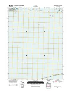
~ Branford OE S CT topo map, 1:24000 scale, 7.5 X 7.5 Minute, Historical, 2012
Branford OE S, Connecticut, USGS topographic map dated 2012.
Includes geographic coordinates (latitude and longitude). This topographic map is suitable for hiking, camping, and exploring, or framing it as a wall map.
Printed on-demand using high resolution imagery, on heavy weight and acid free paper, or alternatively on a variety of synthetic materials.
Topos available on paper, Waterproof, Poly, or Tyvek. Usually shipping rolled, unless combined with other folded maps in one order.
- Product Number: USGS-5644956
- Free digital map download (high-resolution, GeoPDF): Branford OE S, Connecticut (file size: 10 MB)
- Map Size: please refer to the dimensions of the GeoPDF map above
- Weight (paper map): ca. 55 grams
- Map Type: POD USGS Topographic Map
- Map Series: US Topo
- Map Verison: Historical
- Cell ID: 75952
- Datum: North American Datum of 1983
- Map Projection: Transverse Mercator
- Map Cell Name: Branford OE S
- Grid size: 7.5 X 7.5 Minute
- Date on map: 2012
- Map Scale: 1:24000
- Geographical region: Connecticut, United States
Neighboring Maps:
All neighboring USGS topo maps are available for sale online at a variety of scales.
Spatial coverage:
Topo map Branford OE S, Connecticut, covers the geographical area associated the following places:
- Taunton Rock - Linden Point - High Island - Townshend Ledge - Jeffrey Point - Browns Reef - East Indies Rocks - Kidd Harbor - Wheaton Reef - Outer Island - Clam Island - Gull Rocks - Five Foot Rock - Pot Island - Johnson Point - Spectacle Island - Moon Rock - Sedge Island - Hookers Rock - Darrow Rocks - Sumac Island - Branford Reef - Gangway Rock - Thimble Island Harbor - Johnson Point - Moon Rock - Mansfield Point - Farm River - Northwest Reef - Goshen Rock - Sunset Beach - Momauguin Beach - East Reef - Stony Island - Inner Reef - Umbrella Island - Blyn Rock - Outer Thimble - Squaw Rocks - Cow and Calf - Horse Island - Red Point Rocks - Jeffrey Rock - Money Island - Momauguin School - Negro Heads
- Map Area ID: AREA41.2541.125-72.875-72.75
- Northwest corner Lat/Long code: USGSNW41.25-72.875
- Northeast corner Lat/Long code: USGSNE41.25-72.75
- Southwest corner Lat/Long code: USGSSW41.125-72.875
- Southeast corner Lat/Long code: USGSSE41.125-72.75
- Northern map edge Latitude: 41.25
- Southern map edge Latitude: 41.125
- Western map edge Longitude: -72.875
- Eastern map edge Longitude: -72.75


