
~ Kauai HI topo map, 1:250000 scale, 1 X 2 Degree, Historical, 1970, updated 1974
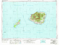
Kauai, Hawaii, USGS topographic map dated 1970.
Includes geographic coordinates (latitude and longitude). This topographic map is suitable for hiking, camping, and exploring, or framing it as a wall map.
Printed on-demand using high resolution imagery, on heavy weight and acid free paper, or alternatively on a variety of synthetic materials.
Topos available on paper, Waterproof, Poly, or Tyvek. Usually shipping rolled, unless combined with other folded maps in one order.
- Product Number: USGS-5644744
- Free digital map download (high-resolution, GeoPDF): Kauai, Hawaii (file size: 15 MB)
- Map Size: please refer to the dimensions of the GeoPDF map above
- Weight (paper map): ca. 55 grams
- Map Type: POD USGS Topographic Map
- Map Series: HTMC
- Map Verison: Historical
- Cell ID: 68853
- Scan ID: 349930
- Imprint Year: 1974
- Woodland Tint: Yes
- Visual Version Number: 1
- Aerial Photo Year: 1965
- Datum: Old Hawaiian
- Map Projection: Transverse Mercator
- Map published by United States Geological Survey
- Map Language: English
- Scanner Resolution: 600 dpi
- Map Cell Name: Kauai
- Grid size: 1 X 2 Degree
- Date on map: 1970
- Map Scale: 1:250000
- Geographical region: Hawaii, United States
Neighboring Maps:
All neighboring USGS topo maps are available for sale online at a variety of scales.
Spatial coverage:
Topo map Kauai, Hawaii, covers the geographical area associated the following places:
- Lāwaʻi - Kapaʻa - Port Allen - Kapaia - Kaunalewa (historical) - Moloaa - Waieli - Wailua - Puʻuwai - Poʻipū - Puhi - Ulu Mahi - Wailua House Lots - Wainiha - Kukuiʻula - Anahola - Puupehu (historical) - Olokele - Nonopahu Village (historical) - Kalāheo - Kaawanui Village - Kaumakani - Kōloa - ʻŌmaʻo - Līhuʻe - Olohena - Waimea - Kapalawai - Koloa Mill - Hanapēpē Heights - Kumukumu - Kalihi Wai - Kamalino (historical) - Kawaihau - Princeville - Kapahi - Waipouli - Numila - Pokii - Hanapēpē - Kapaka (historical) - Opaeopaeilio - Kekaha - Hanalei - Papaloa - Kekupua - Halehomaha - Kīpū - Kiʻekiʻe - Ulu Ko - Nāwiliwili - Kīlauea - Pākalā Village - ʻEleʻele - Pua Loke - Kupolo - Keālia - Hāʻena - Niumalu - Hanamāʻulu - Kiʻi - Wailua Homesteads - Hanalei Homesteads - Mānā
- Map Area ID: AREA22.521.5-160.5833333-159
- Northwest corner Lat/Long code: USGSNW22.5-160.5833333
- Northeast corner Lat/Long code: USGSNE22.5-159
- Southwest corner Lat/Long code: USGSSW21.5-160.5833333
- Southeast corner Lat/Long code: USGSSE21.5-159
- Northern map edge Latitude: 22.5
- Southern map edge Latitude: 21.5
- Western map edge Longitude: -160.5833333
- Eastern map edge Longitude: -159


