
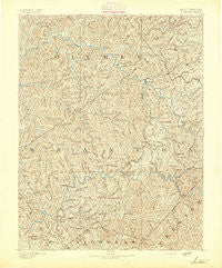
~ Sutton WV topo map, 1:125000 scale, 30 X 30 Minute, Historical, 1893
Sutton, West Virginia, USGS topographic map dated 1893.
Includes geographic coordinates (latitude and longitude). This topographic map is suitable for hiking, camping, and exploring, or framing it as a wall map.
Printed on-demand using high resolution imagery, on heavy weight and acid free paper, or alternatively on a variety of synthetic materials.
Topos available on paper, Waterproof, Poly, or Tyvek. Usually shipping rolled, unless combined with other folded maps in one order.
- Product Number: USGS-5638765
- Free digital map download (high-resolution, GeoPDF): Sutton, West Virginia (file size: 12 MB)
- Map Size: please refer to the dimensions of the GeoPDF map above
- Weight (paper map): ca. 55 grams
- Map Type: POD USGS Topographic Map
- Map Series: HTMC
- Map Verison: Historical
- Cell ID: 395868
- Scan ID: 254019
- Survey Year: 1891
- Datum: Unstated
- Map Projection: Unstated
- Map published by United States Geological Survey
- Map Language: English
- Scanner Resolution: 600 dpi
- Map Cell Name: Sutton
- Grid size: 30 X 30 Minute
- Date on map: 1893
- Map Scale: 1:125000
- Geographical region: West Virginia, United States
Neighboring Maps:
All neighboring USGS topo maps are available for sale online at a variety of scales.
Spatial coverage:
Topo map Sutton, West Virginia, covers the geographical area associated the following places:
- Heaters - Milroy - Defoe (historical) - Bennett (historical) - Bison - Kanawha Drive - Herold - Meadville (historical) - Glendon - Caress - Tesla - Lockney - Latonia - Hyers - Chapel - Sleith (historical) - Gassaway - Clem - Burnsville - Stouts Mills - Morris - Dutch - Strange Creek - Duck - Tague - Hallburg - Sand Fork - Waggy (historical) - Gem - Progress (historical) - Sutton - Frame Knob (historical) - Hope (historical) - Tate - Little Birch - Holly - Moss - Copley - Belfont - Skyles (historical) - McNutt - Tanner - Palmer - Chapman - Rollyson - Holstead (historical) - Twistville (historical) - Copen - Stumptown - Cutlips - Orlando - Rosedale - Donlan - Pembroke - Shadyside - Wade - Gillooly - Bulltown - Peterson - De Kalb - Lucerne - Braxton - Arnold - Cedarville - Revore - Hardman - Alice - Let (historical) - Canfield - Erbacon - Middle Run - Gregory - Rockton - Thrash (historical) - Bealls Mills - Ira - Fairbanks - Bakers Run - O'Brion - Home - Dora - Newville - Flower - Falls Mill - Corley - Wilsie - Finster - Glenville - Bower - Knawl - Harrison - Withers - Truebada - German (historical) - Gillespie - Arnett - Gip - Marpleton - Baldwin - Aspinall
- Map Area ID: AREA3938.5-81-80.5
- Northwest corner Lat/Long code: USGSNW39-81
- Northeast corner Lat/Long code: USGSNE39-80.5
- Southwest corner Lat/Long code: USGSSW38.5-81
- Southeast corner Lat/Long code: USGSSE38.5-80.5
- Northern map edge Latitude: 39
- Southern map edge Latitude: 38.5
- Western map edge Longitude: -81
- Eastern map edge Longitude: -80.5


