
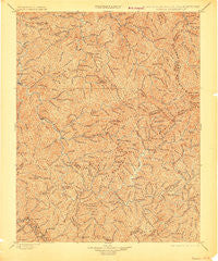
~ Oceana WV topo map, 1:125000 scale, 30 X 30 Minute, Historical, 1898, updated 1907
Oceana, West Virginia, USGS topographic map dated 1898.
Includes geographic coordinates (latitude and longitude). This topographic map is suitable for hiking, camping, and exploring, or framing it as a wall map.
Printed on-demand using high resolution imagery, on heavy weight and acid free paper, or alternatively on a variety of synthetic materials.
Topos available on paper, Waterproof, Poly, or Tyvek. Usually shipping rolled, unless combined with other folded maps in one order.
- Product Number: USGS-5638751
- Free digital map download (high-resolution, GeoPDF): Oceana, West Virginia (file size: 14 MB)
- Map Size: please refer to the dimensions of the GeoPDF map above
- Weight (paper map): ca. 55 grams
- Map Type: POD USGS Topographic Map
- Map Series: HTMC
- Map Verison: Historical
- Cell ID: 395871
- Scan ID: 254002
- Imprint Year: 1907
- Survey Year: 1896
- Datum: Unstated
- Map Projection: Unstated
- Map published by United States Geological Survey
- Map Language: English
- Scanner Resolution: 600 dpi
- Map Cell Name: Oceana
- Grid size: 30 X 30 Minute
- Date on map: 1898
- Map Scale: 1:125000
- Geographical region: West Virginia, United States
Neighboring Maps:
All neighboring USGS topo maps are available for sale online at a variety of scales.
Spatial coverage:
Topo map Oceana, West Virginia, covers the geographical area associated the following places:
- Davin - Lindytown - Becco - Mitchell Heights - West Logan - Bald Knob - Rollins Branch - Uno - Switzer - Robinette - Dog Patch - Chauncey - Hanover - Braeholm - Pettus - Big Branch - Sovereign - North Mitchell Heights - Crites - Packsville - Fanrock - Logan - Monclo - Havana - Landville - Taplin - Red Campbell - Edith - Verner - Saunders - Bim - Secoal - Hatcher - Rossmore - Cazy - Sarah Ann - Wylo - Edwight - Monaville - Echart (historical) - Lanta - Pettry Bottom - Stark - Clear Fork - Emmett - Spruce Valley - Henlawson - Man - Justice Addition - Bigson - Amherstdale - Lillyhaven - Sabine - Accoville - Birchton - Micco - Glen Alum - Hewett - Huff Junction - Keyrock - Sprattsville - Greenville - Anchor - Glen Alum Junction - Superior Bottom - Mallory - Baileysville - Asco - Lorado - Glen Fork - Jesse - Lake - Hutchinson - Manila - McConnell - Oceana - Gillman Bottom - Dobra - Slagle - Kohlsaat - Orville - Combs Addition - West Junction - Don - Kelly - Kopperston - Crystal Block - Neibert - Dabney - Montcoal - Deskin Addition - Rum Junction - Guyan - Turkey - Claypool - Isom - Earling - Aracoma - Tamcliff - Blair
- Map Area ID: AREA3837.5-82-81.5
- Northwest corner Lat/Long code: USGSNW38-82
- Northeast corner Lat/Long code: USGSNE38-81.5
- Southwest corner Lat/Long code: USGSSW37.5-82
- Southeast corner Lat/Long code: USGSSE37.5-81.5
- Northern map edge Latitude: 38
- Southern map edge Latitude: 37.5
- Western map edge Longitude: -82
- Eastern map edge Longitude: -81.5


