
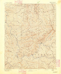
~ Oceana WV topo map, 1:125000 scale, 30 X 30 Minute, Historical, 1891
Oceana, West Virginia, USGS topographic map dated 1891.
Includes geographic coordinates (latitude and longitude). This topographic map is suitable for hiking, camping, and exploring, or framing it as a wall map.
Printed on-demand using high resolution imagery, on heavy weight and acid free paper, or alternatively on a variety of synthetic materials.
Topos available on paper, Waterproof, Poly, or Tyvek. Usually shipping rolled, unless combined with other folded maps in one order.
- Product Number: USGS-5638743
- Free digital map download (high-resolution, GeoPDF): Oceana, West Virginia (file size: 11 MB)
- Map Size: please refer to the dimensions of the GeoPDF map above
- Weight (paper map): ca. 55 grams
- Map Type: POD USGS Topographic Map
- Map Series: HTMC
- Map Verison: Historical
- Cell ID: 395871
- Scan ID: 253998
- Survey Year: 1884
- Datum: Unstated
- Map Projection: Unstated
- Map published by United States Geological Survey
- Map Language: English
- Scanner Resolution: 600 dpi
- Map Cell Name: Oceana
- Grid size: 30 X 30 Minute
- Date on map: 1891
- Map Scale: 1:125000
- Geographical region: West Virginia, United States
Neighboring Maps:
All neighboring USGS topo maps are available for sale online at a variety of scales.
Spatial coverage:
Topo map Oceana, West Virginia, covers the geographical area associated the following places:
- Guyan - Rocklick - Rollins Branch - Braeholm - North Mitchell Heights - Kohlsaat - Garrison - Gilbert - Monclo - Claypool - Lundale - Steeles - Janie - Blue Pennant - Simon - Monaville - Crown - Lacoma - Clinton - Spruce Valley - Deskin Addition - Dog Patch - Sarah Ann - Uno - Fanco - Windom - Lorado - Clear Fork - Mellville - Taplin - Kistler - Ottawa - Baileysville - Rum Junction - Lyburn - Lillyhaven - Craneco - Glen Fork - Isaban - Hensley Heights - Coal Mountain - Hanover - Rita - Man - Birchton - Asco - Red Campbell - Bandytown - Wyoming - Wilkinson - Pettus - Secoal - Baisden - Crooked Creek - Twilight - Pecks Mill - Greenville - Oceana - Pardee - Earling - Aracoma - Horsepen (historical) - Sodom - Stickney - Chauncey - Anchor - Superior Bottom - Jesse - Omar - Slabtown - Sharon Heights - Packsville - Hatcher - Marianna - Peach Creek - Edith - Greenwood - McConnell - Montcoal - Mohawk - Rossmore - Pettry Bottom - Lillydale - Lincoln - Jackson - Huff Junction - Pineville - Justice - Gillman Bottom - Wyoming City - Pondco - Henlawson - Big Branch - Hetzel - Marnie - Marthatown - Longpole - Bruno - Leatherwood - Woosley
- Map Area ID: AREA3837.5-82-81.5
- Northwest corner Lat/Long code: USGSNW38-82
- Northeast corner Lat/Long code: USGSNE38-81.5
- Southwest corner Lat/Long code: USGSSW37.5-82
- Southeast corner Lat/Long code: USGSSE37.5-81.5
- Northern map edge Latitude: 38
- Southern map edge Latitude: 37.5
- Western map edge Longitude: -82
- Eastern map edge Longitude: -81.5


