
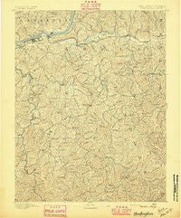
~ Huntington WV topo map, 1:125000 scale, 30 X 30 Minute, Historical, 1892, updated 1895
Huntington, West Virginia, USGS topographic map dated 1892.
Includes geographic coordinates (latitude and longitude). This topographic map is suitable for hiking, camping, and exploring, or framing it as a wall map.
Printed on-demand using high resolution imagery, on heavy weight and acid free paper, or alternatively on a variety of synthetic materials.
Topos available on paper, Waterproof, Poly, or Tyvek. Usually shipping rolled, unless combined with other folded maps in one order.
- Product Number: USGS-5638715
- Free digital map download (high-resolution, GeoPDF): Huntington, West Virginia (file size: 11 MB)
- Map Size: please refer to the dimensions of the GeoPDF map above
- Weight (paper map): ca. 55 grams
- Map Type: POD USGS Topographic Map
- Map Series: HTMC
- Map Verison: Historical
- Cell ID: 395874
- Scan ID: 253979
- Imprint Year: 1895
- Survey Year: 1890
- Datum: Unstated
- Map Projection: Unstated
- Map published by United States Geological Survey
- Map Language: English
- Scanner Resolution: 600 dpi
- Map Cell Name: Huntington
- Grid size: 30 X 30 Minute
- Date on map: 1892
- Map Scale: 1:125000
- Geographical region: West Virginia, United States
Neighboring Maps:
All neighboring USGS topo maps are available for sale online at a variety of scales.
Spatial coverage:
Topo map Huntington, West Virginia, covers the geographical area associated the following places:
- Bartramville - Fourteen (historical) - Miller Estates - Atenville - Sunny Acres - Hurricane Bridge (historical) - Northcott Court - Winslow - Gaylersville - Home Park - Allen (historical) - Stiltner - Lakeland - Guyan Estates - Minerva - Baber - Gilkerson - Armilda - Campbell Park - Melissa - Harveytown - Bartram (historical) - Knollview Estates - Spears (historical) - Getaway - Spurlockville - Sheridan - Sarah - Myra - West Pea Ridge - Garden Farms - Johnson (historical) - Marcum Terrace - Rockville - Owens Crossing - Bolin (historical) - Bradyville - Northwood - East Pea Ridge - Gillette - Park Hills - Sweetland - Guyandotte - Milton - Portersville - Wheeler Ridge - Gill - Salt Rock - Riverview - Lake Washington - West Hamlin - Ferguson - Ona - Kinder (historical) - Inez - Prairietown - Plantation Estates - Mott - Bradrick - Wilson - Lavalette - Fair Place - Fudges Creek - Kiahsville - Ridgewood - Le Mae - Branchland - Banco - Reid - Lattin (historical) - Brentwood - Wewanta - Bowles - Whitaker Terrace - Huntington - Jenks - Imperial Estates - Gardner Terrace - Big Creek - Cranford - Nestlow - Elmwood - West Huntington - Edgemont - Beverly Hills - Stamford Park - Cuzzie - Yates Crossing - Brabant - Fry - Brownstown (historical) - Belle Court - Timberlake - Redwing - Tallwood Acres - Bowen - Cove Gap - Symmes Park - Martha - Fairland
- Map Area ID: AREA38.538-82.5-82
- Northwest corner Lat/Long code: USGSNW38.5-82.5
- Northeast corner Lat/Long code: USGSNE38.5-82
- Southwest corner Lat/Long code: USGSSW38-82.5
- Southeast corner Lat/Long code: USGSSE38-82
- Northern map edge Latitude: 38.5
- Southern map edge Latitude: 38
- Western map edge Longitude: -82.5
- Eastern map edge Longitude: -82


