
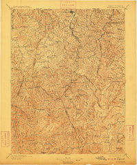
~ Buckhannon WV topo map, 1:125000 scale, 30 X 30 Minute, Historical, 1896, updated 1909
Buckhannon, West Virginia, USGS topographic map dated 1896.
Includes geographic coordinates (latitude and longitude). This topographic map is suitable for hiking, camping, and exploring, or framing it as a wall map.
Printed on-demand using high resolution imagery, on heavy weight and acid free paper, or alternatively on a variety of synthetic materials.
Topos available on paper, Waterproof, Poly, or Tyvek. Usually shipping rolled, unless combined with other folded maps in one order.
- Product Number: USGS-5638677
- Free digital map download (high-resolution, GeoPDF): Buckhannon, West Virginia (file size: 12 MB)
- Map Size: please refer to the dimensions of the GeoPDF map above
- Weight (paper map): ca. 55 grams
- Map Type: POD USGS Topographic Map
- Map Series: HTMC
- Map Verison: Historical
- Cell ID: 395866
- Scan ID: 253953
- Imprint Year: 1909
- Survey Year: 1891
- Datum: Unstated
- Map Projection: Unstated
- Map published by United States Geological Survey
- Map Language: English
- Scanner Resolution: 600 dpi
- Map Cell Name: Buckhannon
- Grid size: 30 X 30 Minute
- Date on map: 1896
- Map Scale: 1:125000
- Geographical region: West Virginia, United States
Neighboring Maps:
All neighboring USGS topo maps are available for sale online at a variety of scales.
Spatial coverage:
Topo map Buckhannon, West Virginia, covers the geographical area associated the following places:
- Daysville - Holly Grove - Helvetia - Woodzell - Gale - Boyd (historical) - Wheeler - Zion - Walkersville - Ivy - Rock Cave - Suncrest - Silica - Heavner (historical) - Hampton - Craddock - Lee Bell - Huff (historical) - Nebo - Arvondale - Goshen - Vernon - Bois - Deanville - Ireland - Cubana - Tallmansville - Kingsville - Georgetown - Brady Gate - Yokum - Ingo - Hettie - Freeman - Spangler - Jewell - Czar - Vandalia - Poling - Imperial - Carter - Pumpkintown - Arlington - Orr - Bablin - Gormley - Newlonton - Blue Rock - Jumbo - Middle Fork (historical) - Kedron - Loda - Rohrbough - Beech Run (historical) - Alexander - Palace Valley - Guardian - Joppa - Hoover Town - Blue Spring - South Buckhannon - Evergreen - Hinkleville - Crawford - Adrian - Big Run - Gaines - Hodam - Wilsontown - Buckhannon - Queens - Selbyville - Bernardstown - Talbott - Heavener Grove - Letch - Valley Head - McCuetown - Middlebrook - Gould - Abbott - Hemlock - Chemical (historical) - Rocky Ford - Orndoff - Overhill - Chapman - Wymer - Canaan - Pickens - Diana - Kanawha Head - Goodwin - Jimtown - Frenchton - Shahan - Vegan - Wildcat (historical) - Alton - Ellamore
- Map Area ID: AREA3938.5-80.5-80
- Northwest corner Lat/Long code: USGSNW39-80.5
- Northeast corner Lat/Long code: USGSNE39-80
- Southwest corner Lat/Long code: USGSSW38.5-80.5
- Southeast corner Lat/Long code: USGSSE38.5-80
- Northern map edge Latitude: 39
- Southern map edge Latitude: 38.5
- Western map edge Longitude: -80.5
- Eastern map edge Longitude: -80


