
~ Exeter NH topo map, 1:62500 scale, 15 X 15 Minute, Historical, 1932, updated 1958
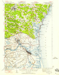
Exeter, New Hampshire, USGS topographic map dated 1932.
Includes geographic coordinates (latitude and longitude). This topographic map is suitable for hiking, camping, and exploring, or framing it as a wall map.
Printed on-demand using high resolution imagery, on heavy weight and acid free paper, or alternatively on a variety of synthetic materials.
Topos available on paper, Waterproof, Poly, or Tyvek. Usually shipping rolled, unless combined with other folded maps in one order.
- Product Number: USGS-5638165
- Free digital map download (high-resolution, GeoPDF): Exeter, New Hampshire (file size: 9 MB)
- Map Size: please refer to the dimensions of the GeoPDF map above
- Weight (paper map): ca. 55 grams
- Map Type: POD USGS Topographic Map
- Map Series: HTMC
- Map Verison: Historical
- Cell ID: 53998
- Scan ID: 330030
- Imprint Year: 1958
- Woodland Tint: Yes
- Survey Year: 1932
- Datum: Unstated
- Map Projection: Polyconic
- Map published by United States Geological Survey
- Keywords: Overedge
- Map Language: English
- Scanner Resolution: 600 dpi
- Map Cell Name: Exeter
- Grid size: 15 X 15 Minute
- Date on map: 1932
- Map Scale: 1:62500
- Geographical region: New Hampshire, United States
Neighboring Maps:
All neighboring USGS topo maps are available for sale online at a variety of scales.
Spatial coverage:
Topo map Exeter, New Hampshire, covers the geographical area associated the following places:
- Salisbury Beach - Gooch Corner - Rings Island - Hampton Beach Trailer Park - Cable Road - Eastman Corners - Lamprey Corners - Sanborn - Rye Beach - Dows Corner - Hampton Falls - Merrimacport - Great Boars Head - Coffins Mill - Hampton Landing - Austin Corners - Weares Mill - Plumbush - Hampton Beach State Recreational Vehicle Park - Weare Corner - Browns Point - South Seabrook - Pine Island - Salisbury - Perkins Hill - Jady Hill - Cemetery Corners - The Plantation - Dunvegan Woods - North Hampton Center - Adams Trailer Park - Knights Crossing - Brick School Corner - Plum Island - Upper Green - Monahan Corners - Salisbury Plains - Riverside - Sanborn Corners - West Newbury - Walton Landing - Curzon Mill - Fogg Corner - Blacksnake Trailer Park - Salisbury Point - Byfield - Shel Al Mobile Estates - Elmwood Corners - Seabrook - Haynes Corner - Kensington - Nason Corners - North Hampton - Newbury Old Town - North Hampton Mobile Home Park - Joppa - Hampton - Fogg Corners - Seabrook Beach - Tappan Corners - Amesbury - Little Boars Head - The Willows - Plaice Cove - Newburyport - South Hampton - Seabrook Station - Cushing - Hampton Beach - Five Corners - Towles Corner - Parkman Corner - Smith Colony - North Beach - The Five Corners - Atlantic - Smithtown - Smith Corner - Exeter - Phillips Park - Prescott Corner - Town Hall Corner - Eastman Point
- Map Area ID: AREA4342.75-71-70.75
- Northwest corner Lat/Long code: USGSNW43-71
- Northeast corner Lat/Long code: USGSNE43-70.75
- Southwest corner Lat/Long code: USGSSW42.75-71
- Southeast corner Lat/Long code: USGSSE42.75-70.75
- Northern map edge Latitude: 43
- Southern map edge Latitude: 42.75
- Western map edge Longitude: -71
- Eastern map edge Longitude: -70.75


