
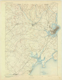
~ Portland ME topo map, 1:62500 scale, 15 X 15 Minute, Historical, 1893
Portland, Maine, USGS topographic map dated 1893.
Includes geographic coordinates (latitude and longitude). This topographic map is suitable for hiking, camping, and exploring, or framing it as a wall map.
Printed on-demand using high resolution imagery, on heavy weight and acid free paper, or alternatively on a variety of synthetic materials.
Topos available on paper, Waterproof, Poly, or Tyvek. Usually shipping rolled, unless combined with other folded maps in one order.
- Product Number: USGS-5638033
- Free digital map download (high-resolution, GeoPDF): Portland, Maine (file size: 6 MB)
- Map Size: please refer to the dimensions of the GeoPDF map above
- Weight (paper map): ca. 55 grams
- Map Type: POD USGS Topographic Map
- Map Series: HTMC
- Map Verison: Historical
- Cell ID: 61226
- Scan ID: 306727
- Survey Year: 1889
- Datum: Unstated
- Map Projection: Unstated
- Map published by United States Geological Survey
- Keywords: Overedge
- Map Language: English
- Scanner Resolution: 600 dpi
- Map Cell Name: Portland
- Grid size: 15 X 15 Minute
- Date on map: 1893
- Map Scale: 1:62500
- Geographical region: Maine, United States
Neighboring Maps:
All neighboring USGS topo maps are available for sale online at a variety of scales.
Spatial coverage:
Topo map Portland, Maine, covers the geographical area associated the following places:
- Pine Point Beach - Sunset Park - Danish Village (historical) - Old Orchard Beach - Summit View Park (historical) - Sagamore Village - Boothbay Park - South Gorham - Highlands - North Scarborough - Bradleys Corner - Libbytown - Deering - Lone Creek Village (historical) - Pleasantdale - Eight Corners - North Deering - Rosemont - Grubb Hill (historical) - Little Falls - West Scarborough - Cumberland Mills - Sandy Brook - Deering Junction - Scarborough - Morrills Corner - Saco - Westbrook - West Gorham - Town Landing - Blue Point - Brighton Corner - Prides Corner - Ocean Park - South Windham - Stanwood Park - Crocketts Corner - Knightville - Rigby (historical) - Oakdale - Lunts Corner - West Falmouth Corner - Thornton Heights - West Falmouth (historical) - Surfside - South Portland Gardens - Milliken Mills - Gorham - Broadview Park - Pine Point - Nasons Corner - South Buxton - Gag Corner - Babb Corner - Prouts Neck - Cash Corner - Pleasant Hill - Village of Halidon (historical) - Garrison Hills Estates - Pleasant Hill - Woodfords Corner - East Deering - Woodfords - Portland - Dunegrass Golf Community - Rosemont - Pine Park - Stroudwater - Mosher Corner - Ligonia - Grand Beach - Riverton - Oak Hill - Higgins Beach - Highland Lake - West End
- Map Area ID: AREA43.7543.5-70.5-70.25
- Northwest corner Lat/Long code: USGSNW43.75-70.5
- Northeast corner Lat/Long code: USGSNE43.75-70.25
- Southwest corner Lat/Long code: USGSSW43.5-70.5
- Southeast corner Lat/Long code: USGSSE43.5-70.25
- Northern map edge Latitude: 43.75
- Southern map edge Latitude: 43.5
- Western map edge Longitude: -70.5
- Eastern map edge Longitude: -70.25


