
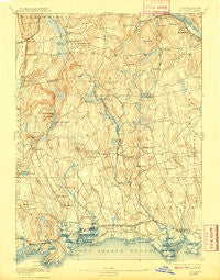
~ Guilford CT topo map, 1:62500 scale, 15 X 15 Minute, Historical, 1893, updated 1909
Guilford, Connecticut, USGS topographic map dated 1893.
Includes geographic coordinates (latitude and longitude). This topographic map is suitable for hiking, camping, and exploring, or framing it as a wall map.
Printed on-demand using high resolution imagery, on heavy weight and acid free paper, or alternatively on a variety of synthetic materials.
Topos available on paper, Waterproof, Poly, or Tyvek. Usually shipping rolled, unless combined with other folded maps in one order.
- Product Number: USGS-5637745
- Free digital map download (high-resolution, GeoPDF): Guilford, Connecticut (file size: 9 MB)
- Map Size: please refer to the dimensions of the GeoPDF map above
- Weight (paper map): ca. 55 grams
- Map Type: POD USGS Topographic Map
- Map Series: HTMC
- Map Verison: Historical
- Cell ID: 54907
- Scan ID: 331043
- Imprint Year: 1909
- Survey Year: 1890
- Datum: Unstated
- Map Projection: Unstated
- Map published by United States Geological Survey
- Keywords: Overedge
- Map Language: English
- Scanner Resolution: 600 dpi
- Map Cell Name: Guilford
- Grid size: 15 X 15 Minute
- Date on map: 1893
- Map Scale: 1:62500
- Geographical region: Connecticut, United States
Neighboring Maps:
All neighboring USGS topo maps are available for sale online at a variety of scales.
Spatial coverage:
Topo map Guilford, Connecticut, covers the geographical area associated the following places:
- Stony Creek - Durham Center - Cedar Lake - Haddam - Clinton Beach - Lake View - Ninevah (historical) - West Haddam - Rock Landing - Ponset - Ridgewood - Madison - Little City - Durham - East River - Killingworth - Kelseytown - Middle Beach - Flanders (historical) - Seaview Beach - Nut Plains - North Madison - Guilford - Hoadley Neck - Harbor View - Rockland - Lord Corner (historical) - Leetes Island - Spruce Corner (historical) - Duck Island Roads - Clinton - North Guilford - Beaver Head Corner - Higganum - Arnolds - Podunk
- Map Area ID: AREA41.541.25-72.75-72.5
- Northwest corner Lat/Long code: USGSNW41.5-72.75
- Northeast corner Lat/Long code: USGSNE41.5-72.5
- Southwest corner Lat/Long code: USGSSW41.25-72.75
- Southeast corner Lat/Long code: USGSSE41.25-72.5
- Northern map edge Latitude: 41.5
- Southern map edge Latitude: 41.25
- Western map edge Longitude: -72.75
- Eastern map edge Longitude: -72.5


