
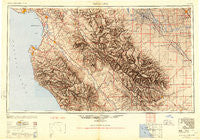
~ Santa Cruz CA topo map, 1:250000 scale, 1 X 2 Degree, Historical, 1948, updated 1951
Santa Cruz, California, USGS topographic map dated 1948.
Includes geographic coordinates (latitude and longitude). This topographic map is suitable for hiking, camping, and exploring, or framing it as a wall map.
Printed on-demand using high resolution imagery, on heavy weight and acid free paper, or alternatively on a variety of synthetic materials.
Topos available on paper, Waterproof, Poly, or Tyvek. Usually shipping rolled, unless combined with other folded maps in one order.
- Product Number: USGS-5637665
- Free digital map download (high-resolution, GeoPDF): Santa Cruz, California (file size: 21 MB)
- Map Size: please refer to the dimensions of the GeoPDF map above
- Weight (paper map): ca. 55 grams
- Map Type: POD USGS Topographic Map
- Map Series: HTMC
- Map Verison: Historical
- Cell ID: 74982
- Scan ID: 302143
- Imprint Year: 1951
- Aerial Photo Year: 1945
- Datum: NAD27
- Map Projection: Transverse Mercator
- Shaded Relief map: Yes
- Map published by United States Army Corps of Engineers
- Map published by United States Army
- Map Language: English
- Scanner Resolution: 600 dpi
- Map Cell Name: Monterey
- Grid size: 1 X 2 Degree
- Date on map: 1948
- Map Scale: 1:250000
- Geographical region: California, United States
Neighboring Maps:
All neighboring USGS topo maps are available for sale online at a variety of scales.
Spatial coverage:
Topo map Santa Cruz, California, covers the geographical area associated the following places:
- Oxalis - Arbios - Nashua - Strongs Mobile Village - Hamburg Farms - Pacific Grove - San Felipe - Petroleum (historical) - Dunbarton (historical) - Fort Romie - Soquel - Duri (historical) - Storey - Ocean Breeze Mobile Home Park - Levis - Tony Ziro Mobile Living Mobile Home Park - Cromir - Mendota - Natividad - Westside - Port Watsonville (historical) - Orchard Lane Mobile Home Park - Notleys Landing - Molus - Pajaro Mobile Manor - Huron - Leonard (historical) - Italian Swiss Colony - Carmel Valley Manor - Brookvale Terrace Mobile Home Park - Del Monte - Rob Roy Junction - Pinnacles - Quail Meadows - Seacliff - Confederate Corners - Santa Rita - Larkin Valley - Parkwood - Gabilan (historical) - Giffen Cantua Ranch - Old Hilltown - Miller - San Ardo - Posts - Aptos - Tres Pinos - Majors - Sycamore Flat - Salinas - Castle Mobile Estates - Old Mill Park Mobile Home Park - Panoche Junction - Turk - Morse - Madera - Vega (historical) - Firebaugh - Creekside - Marina - Ripperdan - Wood Ranch - Chittenden - Sand City - Camphora - Freedom - Fort Ord Village (historical) - Plantel (historical) - Biola - Mission Oaks Mobile Home Community - Llanada - New Brighton (historical) - Helm - Jamesan - Ambler Park - Elkhorn - Hollister - Rio Plaza Mobile Home Park - Tradewinds Mobile Home Park - Parkfield Junction - Spence - La Selva Beach - Meadows Manor Mobile Home Park - Pebble Beach - Rancho Tierra Grande - Five Points - Del Monte Heights - Carmel Valley - Trailer Haven - Prunedale - Allegro Heights - Idria - Corralitos - Oilfields - Mercey Hot Springs - Pacific Grove Acres - Shangri La Estates - Borden - San Benito - Soledad
- Map Area ID: AREA3736-122.2-120
- Northwest corner Lat/Long code: USGSNW37-122.2
- Northeast corner Lat/Long code: USGSNE37-120
- Southwest corner Lat/Long code: USGSSW36-122.2
- Southeast corner Lat/Long code: USGSSE36-120
- Northern map edge Latitude: 37
- Southern map edge Latitude: 36
- Western map edge Longitude: -122.2
- Eastern map edge Longitude: -120


