
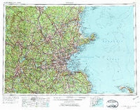
~ Boston MA topo map, 1:250000 scale, 1 X 2 Degree, Historical, 1956, updated 1974
Boston, Massachusetts, USGS topographic map dated 1956.
Includes geographic coordinates (latitude and longitude). This topographic map is suitable for hiking, camping, and exploring, or framing it as a wall map.
Printed on-demand using high resolution imagery, on heavy weight and acid free paper, or alternatively on a variety of synthetic materials.
Topos available on paper, Waterproof, Poly, or Tyvek. Usually shipping rolled, unless combined with other folded maps in one order.
- Product Number: USGS-5636171
- Free digital map download (high-resolution, GeoPDF): Boston, Massachusetts (file size: 28 MB)
- Map Size: please refer to the dimensions of the GeoPDF map above
- Weight (paper map): ca. 55 grams
- Map Type: POD USGS Topographic Map
- Map Series: HTMC
- Map Verison: Historical
- Cell ID: 68685
- Scan ID: 353232
- Imprint Year: 1974
- Woodland Tint: Yes
- Aerial Photo Year: 1952
- Edit Year: 1970
- Field Check Year: 1956
- Datum: Unstated
- Map Projection: Transverse Mercator
- Map published by United States Geological Survey
- Map Language: English
- Scanner Resolution: 600 dpi
- Map Cell Name: Boston
- Grid size: 1 X 2 Degree
- Date on map: 1956
- Map Scale: 1:250000
- Geographical region: Massachusetts, United States
Neighboring Maps:
All neighboring USGS topo maps are available for sale online at a variety of scales.
Spatial coverage:
Topo map Boston, Massachusetts, covers the geographical area associated the following places:
- West Townsend - Smithtown - Chandler Hill - Dorchester - Kittville - Dorothy Pond - West Gloucester - Shawsheen Heights - Meriams Corner - North Oxford - Pelham - East Braintree - South Brookline - South Hanover - Manchester - Wilkinsonville - Wessonville - Buffumville - New Town (historical) - New Boston - Sterling Junction - Mantyranta - Waites Corner - Cambridge - Beverly Cove - Woodland Park - Salisbury - South Lincoln - Medfield Junction - Plumbush - Hathorne - Shel Al Mobile Estates - Morseville - Joppa - Oakland Square - Derry - Temple - Marshfield Hills - North Hanover - Webster - Suburban Village Trailer Park - Monponsett - Hollis Depot - Wellesley Hills - Andover - Lakeview - Parkman Corner - West Newbury - Brighton - Salem - Marlborough - Brockton - Greendale - North End - Doles Corner - Kelly Corner - June Street - Rice Square - Community Park - West Duxbury - Seabrook Beach - Tuttleville - Townsend Harbor - Centralville - Walpole - Whiteville - Germantown - Bay Village - Northville (historical) - Ponakin Mill - Gardner - Squantum - Woburn - West Hanover - Malden Centre - Lunenburg Station - Highlands - Bayside - Centerville - Five Corners - Olde English Village - Prospectville - Hampstead - Noyes Terrace - Curtis Crossing - Hamilton - South Berlin - Smith Corner - Bedford - Winthrop - Babbatasset Village - Lakeview Heights - Columbus Park - Paper Mill Village - West Walpole - South Commons - Beach Bluff - West Village - South Lowell - Eden Square
- Map Area ID: AREA4342-72-70
- Northwest corner Lat/Long code: USGSNW43-72
- Northeast corner Lat/Long code: USGSNE43-70
- Southwest corner Lat/Long code: USGSSW42-72
- Southeast corner Lat/Long code: USGSSE42-70
- Northern map edge Latitude: 43
- Southern map edge Latitude: 42
- Western map edge Longitude: -72
- Eastern map edge Longitude: -70


