
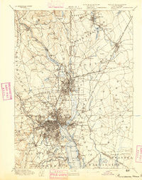
~ Providence RI topo map, 1:62500 scale, 15 X 15 Minute, Historical, 1894
Providence, Rhode Island, USGS topographic map dated 1894.
Includes geographic coordinates (latitude and longitude). This topographic map is suitable for hiking, camping, and exploring, or framing it as a wall map.
Printed on-demand using high resolution imagery, on heavy weight and acid free paper, or alternatively on a variety of synthetic materials.
Topos available on paper, Waterproof, Poly, or Tyvek. Usually shipping rolled, unless combined with other folded maps in one order.
- Product Number: USGS-5635833
- Free digital map download (high-resolution, GeoPDF): Providence, Rhode Island (file size: 8 MB)
- Map Size: please refer to the dimensions of the GeoPDF map above
- Weight (paper map): ca. 55 grams
- Map Type: POD USGS Topographic Map
- Map Series: HTMC
- Map Verison: Historical
- Cell ID: 61341
- Scan ID: 352968
- Survey Year: 1887
- Datum: Unstated
- Map Projection: Unstated
- Map published by United States Geological Survey
- Map Language: English
- Scanner Resolution: 600 dpi
- Map Cell Name: Providence
- Grid size: 15 X 15 Minute
- Date on map: 1894
- Map Scale: 1:62500
- Geographical region: Rhode Island, United States
Neighboring Maps:
All neighboring USGS topo maps are available for sale online at a variety of scales.
Spatial coverage:
Topo map Providence, Rhode Island, covers the geographical area associated the following places:
- Omega (historical) - East Junction - Centerdale - Carpenters Corner - Wayland - Sayles Bleachery - Woodville - Kent Corner - Manville - Harris - Foxes Hill - Pocasset - Perrins Crossing - Seekonk - Marieville - Edgewood - Manton - Riverside - Silver Spring - Attleboro - North Seekonk - Rumford - East Providence - Hebronville - Fairlawn - Christian Hill - Woodlawn - Lippitt Estate - Garden City - Ingrams Corner - Pawtucket - Vue de l'eau - Merino - Cumberland - Allendale - Attleboro Falls - Monroes - Berkeley - Pawtuxet - Attleborough City - Meshanticut - Leonard Corner - Arnold Mills - Phillipsdale - Luthers Corners - Silver Hook - Sockanosset - Lonsdale - North Providence - Fruit Hill - Happy Hollow - Olneyville - Saylesville Highlands - Armington Corner - Adamsdale - Oaklawn - Darlington - South Rehoboth - Briggs Corner - Washington Park - North Attleboro - Lymansville - Abbott Run - Albion - Providence - Watchemoket - Hughesdale - Cumberland Hill - Quinnville - Fort Hill (historical) - Luthers Corners - Wanskuck - South Seekonk - Cork Hill (historical) - Pettaconsett - Miles Bridge - Silver Lake - Dodgeville - Dyerville - Monastery Heights - Saylesville - Perryville - Six Corners - Knightsville - Thornton - Lakewood - Norwood - Wayland (historical) - Diamond Hill - Camp Herbron - Geneva - Elmwood - Greystone - Central Falls - East Providence Center - Bellefonte (historical) - Cranston - South Attleboro - Lime Rock - Hampden Meadows
- Map Area ID: AREA4241.75-71.5-71.25
- Northwest corner Lat/Long code: USGSNW42-71.5
- Northeast corner Lat/Long code: USGSNE42-71.25
- Southwest corner Lat/Long code: USGSSW41.75-71.5
- Southeast corner Lat/Long code: USGSSE41.75-71.25
- Northern map edge Latitude: 42
- Southern map edge Latitude: 41.75
- Western map edge Longitude: -71.5
- Eastern map edge Longitude: -71.25


