
~ Eastville VA topo map, 1:250000 scale, 2 X 1 Degree, Historical, 1946, updated 1971
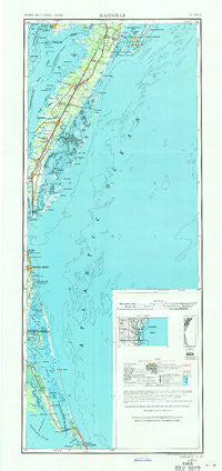
Eastville, Virginia, USGS topographic map dated 1946.
Includes geographic coordinates (latitude and longitude). This topographic map is suitable for hiking, camping, and exploring, or framing it as a wall map.
Printed on-demand using high resolution imagery, on heavy weight and acid free paper, or alternatively on a variety of synthetic materials.
Topos available on paper, Waterproof, Poly, or Tyvek. Usually shipping rolled, unless combined with other folded maps in one order.
- Product Number: USGS-5631351
- Free digital map download (high-resolution, GeoPDF): Eastville, Virginia (file size: 14 MB)
- Map Size: please refer to the dimensions of the GeoPDF map above
- Weight (paper map): ca. 55 grams
- Map Type: POD USGS Topographic Map
- Map Series: HTMC
- Map Verison: Historical
- Cell ID: 320750
- Scan ID: 189248
- Imprint Year: 1971
- Woodland Tint: Yes
- Aerial Photo Year: 1938
- Edit Year: 1969
- Datum: Unstated
- Map Projection: Transverse Mercator
- Map published by United States Geological Survey
- Map Language: English
- Scanner Resolution: 600 dpi
- Map Cell Name: Eastville
- Grid size: 2 X 1 Degree
- Date on map: 1946
- Map Scale: 1:250000
- Geographical region: Virginia, United States
Neighboring Maps:
All neighboring USGS topo maps are available for sale online at a variety of scales.
Spatial coverage:
Topo map Eastville, Virginia, covers the geographical area associated the following places:
- Bloxom - Johnsontown - Townsend - Chancetown - Mount Nebo - Kendall Grove - Kitty Hawk Beach - Bayview - Chase Crossing - Vaucluse Shores - Mamie - Makemie Park - Wild Duck Dunes - Daugherty - High Woods - Horntown - Nash Corner - Bayside - Sand Dollar Shores - Indian Hammock - Shelltown - Cashville - Jordan - Virginia Beach - Sanderling - Little Salisbury - Tunnels Mill - North End (historical) - Olds - Stumptown - Lake View - Hargraves Bench - Lawson - Capeville - Red Hill - Sea Ridge - Peaceful Beach - Mariners - Flag Pond Landing - Seaside Mobile Village - Carolina Dunes - Cats Bridge - Parksley - Graysville - Pennyville - Black Point Landing - Highland Heights - Public Landing - Southern Shores - Bertha - Sign Post - Grotons - Knotts Island - Accomac - Poulson - Poteskeet Village - Powells Point - Tuckahoe - Corolla - Sandy Ridge - Trower - Birdsnest - Schooner Ridge - Jersey - Duck - Sackertown - Ocean Dunes - TB Crossroads - Mears Station - Marionville - Dalbys - Rudee Heights - Locustville - Middlesex - Point Harbor - Sigma - Howard (historical) - Eastville Station - Hopeton - Dreamland Mobile Home Park - Bulls Landing - Stewarts Landing - Ticktown - Miona - Belle Haven - Harbinger - Nottingham - Hare Valley - Saltaire - Grandy - Osprey - Smith Beach - Dam Neck Corner - Cedar View - Waterlily - Coal Kiln Crossing - Parsonville - Johnson Cove - North Virginia Beach - Croatan Shores
- Map Area ID: AREA3836-76-75
- Northwest corner Lat/Long code: USGSNW38-76
- Northeast corner Lat/Long code: USGSNE38-75
- Southwest corner Lat/Long code: USGSSW36-76
- Southeast corner Lat/Long code: USGSSE36-75
- Northern map edge Latitude: 38
- Southern map edge Latitude: 36
- Western map edge Longitude: -76
- Eastern map edge Longitude: -75


