
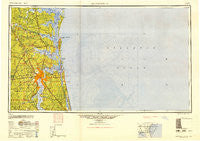
~ Jacksonville FL topo map, 1:250000 scale, 1 X 2 Degree, Historical, 1948
Jacksonville, Florida, USGS topographic map dated 1948.
Includes geographic coordinates (latitude and longitude). This topographic map is suitable for hiking, camping, and exploring, or framing it as a wall map.
Printed on-demand using high resolution imagery, on heavy weight and acid free paper, or alternatively on a variety of synthetic materials.
Topos available on paper, Waterproof, Poly, or Tyvek. Usually shipping rolled, unless combined with other folded maps in one order.
- Product Number: USGS-5621732
- Free digital map download (high-resolution, GeoPDF): Jacksonville, Florida (file size: 23 MB)
- Map Size: please refer to the dimensions of the GeoPDF map above
- Weight (paper map): ca. 55 grams
- Map Type: POD USGS Topographic Map
- Map Series: HTMC
- Map Verison: Historical
- Cell ID: 68840
- Scan ID: 346818
- Woodland Tint: Yes
- Aerial Photo Year: 1942
- Datum: NAD27
- Map Projection: Transverse Mercator
- Map published by United States Army Corps of Engineers
- Map published by United States Army
- Map Language: English
- Scanner Resolution: 600 dpi
- Map Cell Name: Jacksonville
- Grid size: 1 X 2 Degree
- Date on map: 1948
- Map Scale: 1:250000
- Geographical region: Florida, United States
Neighboring Maps:
All neighboring USGS topo maps are available for sale online at a variety of scales.
Spatial coverage:
Topo map Jacksonville, Florida, covers the geographical area associated the following places:
- Allens Mobile Home Park - Marianna (historical) - Brothers Mobile Home Park - Holiday Harbor - Marshall Plantation (historical) - Kings Ferry - North Shore - Hopewell - Plummers - Palmas Realas - Lackawanna - Crystal Oaks Mobile Home Park - Camden Point Mobile Home Park - Bayard - Riverview - Dames Point Manor - Clarks Bluff - Terra Haute - Neptune Beach - Harrietts Bluff - Oak Ridge Mobile Home Village - Pickettville - Buccaneer Mobile Home Park - Black Hammock - Biltmore - Southside Estates - Amelia Island Mobile Home Park - Alcoy Road Mobile Home Park - Ratliff - Wonderwood - Flea Hill - Oak Hill Park - Lake Forest - Beacon Hills - Hedges - Cary - Pecan Park - Dunn Creek - Nassau Acres Mobile Home Park - Oakhurst - Jerusalem - Oak Landing - Harbor Pines - Philips - Magnolia Springs - Paradise Village Mobile Home Park - Connie Jean Mobile Home Park - Goodbys - Mickler Landing - Rhondas Trailer Park - Caleb - Braddocks Trailer Park - Westwood - Lake Park Estates - Shellbine - Hibernia - Atlantic Beach - Mission Trace - Magnolia Gardens - Briarwood Mobile Home Park - Dardens Mobile Home Park - Wesley Manor Retirement Village - Orange Park - Cosmo - Twentymile - Colesburg - Cedar Point - Leon Mobile Home Park - Trout River Mobile Home Park - Floral Bluff - Edgewood - Refuge (historical) - Dahoma - Amelia City - Beverly Hills - Kinlaw - Larsen - Magnolia Circle Manufactured Home Community - Italia - Clarks Bluff - Town and Country Mobile Home Park - Azalea Terrace - Cypress Lake Estates - River Oaks - Mandarin - Harrietts Bluff Village - Portside Mobile Home Park - Sundown Estates Mobile Home Park - Thunderbird Mobile Home Park - Golden Nuggett Mobile Home Park - Quinlan - North River Oaks - Clarksville - Burnt Fort - Jefferson - Woodstock (historical) - East Mandarin - Oak Hill - Solite (historical) - Hatch Road Mobile Home Park
- Map Area ID: AREA3130-82-80
- Northwest corner Lat/Long code: USGSNW31-82
- Northeast corner Lat/Long code: USGSNE31-80
- Southwest corner Lat/Long code: USGSSW30-82
- Southeast corner Lat/Long code: USGSSE30-80
- Northern map edge Latitude: 31
- Southern map edge Latitude: 30
- Western map edge Longitude: -82
- Eastern map edge Longitude: -80


