
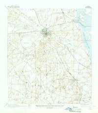
~ Ocala FL topo map, 1:62500 scale, 15 X 15 Minute, Historical, 1895, updated 1949
Ocala, Florida, USGS topographic map dated 1895.
Includes geographic coordinates (latitude and longitude). This topographic map is suitable for hiking, camping, and exploring, or framing it as a wall map.
Printed on-demand using high resolution imagery, on heavy weight and acid free paper, or alternatively on a variety of synthetic materials.
Topos available on paper, Waterproof, Poly, or Tyvek. Usually shipping rolled, unless combined with other folded maps in one order.
- Product Number: USGS-5621408
- Free digital map download (high-resolution, GeoPDF): Ocala, Florida (file size: 6 MB)
- Map Size: please refer to the dimensions of the GeoPDF map above
- Weight (paper map): ca. 55 grams
- Map Type: POD USGS Topographic Map
- Map Series: HTMC
- Map Verison: Historical
- Cell ID: 60461
- Scan ID: 347732
- Imprint Year: 1949
- Visual Version Number: 1
- Survey Year: 1892
- Datum: Unstated
- Map Projection: Polyconic
- Map published by United States Geological Survey
- Map Language: English
- Scanner Resolution: 600 dpi
- Map Cell Name: Ocala
- Grid size: 15 X 15 Minute
- Date on map: 1895
- Map Scale: 1:62500
- Geographical region: Florida, United States
Neighboring Maps:
All neighboring USGS topo maps are available for sale online at a variety of scales.
Spatial coverage:
Topo map Ocala, Florida, covers the geographical area associated the following places:
- Maricamp - Martel - Ocala Municipal Trailer Park - Santos Mobile Home Park - Oakwood Mobile Manor Mobile Home Park - Meadow Lark Mobile Home Park - Westside Trailer Park - Huntington - Jack Mobile Home Park - Hopes Mobile Home Park - Quail Meadows - Oakcrest Mobile Home Park - Shady Acres Adult Mobile Home Park - Compton Mobile Home Park - Gateway Mobile Home Park - Foxwood Farms Mobile Home Park - Ocala Sun RV Resort - Shady - Pine Village Mobile Home Park - Ocala - Santos - Misty Lane Mobile Home Park - A and M Mobile Home Park - Monroes Corner - White Oaks Mobile Home Park - Silver Oaks Mobile Home Park - Rolling Greens Mobile Home Park - Danks Corner - Westwood Mobile Home Park - Western Mobile Home Park - Arbors of Ocala Mobile Home Park - Edgewood Mobile Home Park - Green Oaks Manor Mobile Home Park - Pioneer Mobile Home Park - Sweetwater Oaks Mobile Home Park - Golden Pond Village Manufactured Home Community - Lindale Mobile Home Park - Montague - Craft Travel Trailer Park - Silver Springs - Happy Acres Mobile Home Park - Ocala Waterway - Belleview Heights - Shady Road Villas Mobile Home Park - Camp Roosevelt - Golden Hills - Ocala Ridge - Par I Mobile Home Park - Marion Oaks - Belleview - Cedar Grove Mobile Home Park - Southeast Side Mobile Home Park - Wagon Wheel Mobile Home Park - Pine Manor East Mobile Home Park - Ross Prairie - Nautilus Trailer Park - Penny Park Estates Mobile Home Park - Ocala Thoroughbred Acres - Silver Springs Shores - Belleview Mobile Home Park - Shady Oaks Mobile Home Park - Shady Grove Mobile Home Park - Blue Skies Estates Mobile Home Park - Summerfield - Live Oaks Mobile Home Park - Saddle Oak Club Mobile Home Park - Spanish Palm Estates Mobile Home Park - Twin Oaks Mobile Home Park - Golden Meadows Mobile Home Park - The Falls of Ocala Mobile Home Park - Fairfield Village of Ocala Mobile Home Park - West Village Mobile Home Park - Briar Patch Mobile Home Park - Wesley Mobile Home Park - Golden Hills Park Mobile Home Park - Cherry Hill Mobile Home Park - Saddle Oak Club - Terry's Mobile Home Park - Country Aire Mobile Home Park - Cala Springs Mobile Home Park - Paddock Park South Mobile Home Park - Dogwood Acres Mobile Home Park - Bahia Oaks - Country Oaks Mobile Home Park - Country Town Village Mobile Home Park - Spanish Oaks Mobile Home Park
- Map Area ID: AREA29.2529-82.25-82
- Northwest corner Lat/Long code: USGSNW29.25-82.25
- Northeast corner Lat/Long code: USGSNE29.25-82
- Southwest corner Lat/Long code: USGSSW29-82.25
- Southeast corner Lat/Long code: USGSSE29-82
- Northern map edge Latitude: 29.25
- Southern map edge Latitude: 29
- Western map edge Longitude: -82.25
- Eastern map edge Longitude: -82


