
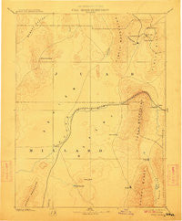
~ Sevier Desert UT topo map, 1:250000 scale, 1 X 1 Degree, Historical, 1885, updated 1911
Sevier Desert, Utah, USGS topographic map dated 1885.
Includes geographic coordinates (latitude and longitude). This topographic map is suitable for hiking, camping, and exploring, or framing it as a wall map.
Printed on-demand using high resolution imagery, on heavy weight and acid free paper, or alternatively on a variety of synthetic materials.
Topos available on paper, Waterproof, Poly, or Tyvek. Usually shipping rolled, unless combined with other folded maps in one order.
- Product Number: USGS-5619014
- Free digital map download (high-resolution, GeoPDF): Sevier Desert, Utah (file size: 5 MB)
- Map Size: please refer to the dimensions of the GeoPDF map above
- Weight (paper map): ca. 55 grams
- Map Type: POD USGS Topographic Map
- Map Series: HTMC
- Map Verison: Historical
- Cell ID: 322266
- Scan ID: 251807
- Imprint Year: 1911
- Datum: Unstated
- Map Projection: Unstated
- Map published by United States Geological Survey
- Map Language: English
- Scanner Resolution: 600 dpi
- Map Cell Name: Delta E
- Grid size: 1 X 1 Degree
- Date on map: 1885
- Map Scale: 1:250000
- Geographical region: Utah, United States
Neighboring Maps:
All neighboring USGS topo maps are available for sale online at a variety of scales.
Spatial coverage:
Topo map Sevier Desert, Utah, covers the geographical area associated the following places:
- Champlin - McCornick - Maple Grove - Leamington - Hinckley - Hillside (historical) - Soma - Greenwood - Dividend - Mammoth Junction - Eureka - Mack - Lynndyl - Mammoth - Sugarville - Delta - Diamond - Silver City - Tintic Junction - Knightville - McIntyre - Homansville - Parley - Van - Strong - Uisco - Neels - Harding - Jericho - Holden - Knight - Sutherland - Deseret - Scipio - Mills - Oasis - Dennis - Abraham - Oak City - Clear Lake
- Map Area ID: AREA4039-113-112
- Northwest corner Lat/Long code: USGSNW40-113
- Northeast corner Lat/Long code: USGSNE40-112
- Southwest corner Lat/Long code: USGSSW39-113
- Southeast corner Lat/Long code: USGSSE39-112
- Northern map edge Latitude: 40
- Southern map edge Latitude: 39
- Western map edge Longitude: -113
- Eastern map edge Longitude: -112


