
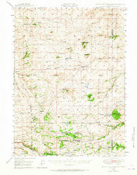
~ Ragged Top Mountain WY topo map, 1:62500 scale, 15 X 15 Minute, Historical, 1948, updated 1965
Ragged Top Mountain, Wyoming, USGS topographic map dated 1948.
Includes geographic coordinates (latitude and longitude). This topographic map is suitable for hiking, camping, and exploring, or framing it as a wall map.
Printed on-demand using high resolution imagery, on heavy weight and acid free paper, or alternatively on a variety of synthetic materials.
Topos available on paper, Waterproof, Poly, or Tyvek. Usually shipping rolled, unless combined with other folded maps in one order.
- Product Number: USGS-5617432
- Free digital map download (high-resolution, GeoPDF): Ragged Top Mountain, Wyoming (file size: 8 MB)
- Map Size: please refer to the dimensions of the GeoPDF map above
- Weight (paper map): ca. 55 grams
- Map Type: POD USGS Topographic Map
- Map Series: HTMC
- Map Verison: Historical
- Cell ID: 61419
- Scan ID: 342232
- Imprint Year: 1965
- Woodland Tint: Yes
- Aerial Photo Year: 1947
- Field Check Year: 1948
- Datum: NAD27
- Map Projection: Polyconic
- Map published by United States Geological Survey
- Map published by United States Army Corps of Engineers
- Map Language: English
- Scanner Resolution: 600 dpi
- Map Cell Name: Ragged Top Mountain
- Grid size: 15 X 15 Minute
- Date on map: 1948
- Map Scale: 1:62500
- Geographical region: Wyoming, United States
Neighboring Maps:
All neighboring USGS topo maps are available for sale online at a variety of scales.
Spatial coverage:
Topo map Ragged Top Mountain, Wyoming, covers the geographical area associated the following places:
- Cashs Home Dam - King Brothers Ranch - Artillery Spring - McKechnie Meadow - King Mountain - KUWR-FM (Laramie) - Weddle Claims Mine - Powell Mountain - Eagle Rock - Alvie Number One Reservoir - Davis Range Camp - Middle Branch Middle Lodgepole Creek - Ragged Top Mountain - Ridge Camp Trail - Happy Jack Winter Sports Area - North McKechnie Meadow - Harry Brown Ranch - KIMX-FM (Laramie) - Dirty Mountain - Lake Hill - University Quarry - Cashs Home Reservoir - Pole Creek Campground - Horse Creek Lakes - KRQU-FM (Laramie) - Sherman Hill - Meadow Fork Branch - Pilot Hill - Bare Knob - Tie City Campground - Dry Gulch - Laycock Spring - Green Top Mountain - Schoolhouse Creek - North Branch Middle Lodgepole Creek - Tetsc Ranch - Mine Camp - Horse Creek Trail - Peggy Rock - Telephone Spring - Browns Ranch - Horse Mountain - KCGY-FM (Laramie) - Alvie Number One Dam - Warren Livestock Summer Camp - Pitcher Hill - Davis Ranch - Yellow Pine Campground - Telephone Spring Picnic Area - McKechnie Ranch - Warren Livestock Summer Camp - Coles Ranch - Big Hill - Pinnacle Peaks - Cameron Ranch - Spring Creek
- Map Area ID: AREA41.541.25-105.5-105.25
- Northwest corner Lat/Long code: USGSNW41.5-105.5
- Northeast corner Lat/Long code: USGSNE41.5-105.25
- Southwest corner Lat/Long code: USGSSW41.25-105.5
- Southeast corner Lat/Long code: USGSSE41.25-105.25
- Northern map edge Latitude: 41.5
- Southern map edge Latitude: 41.25
- Western map edge Longitude: -105.5
- Eastern map edge Longitude: -105.25


