
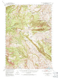
~ Pat O Hara Mountain WY topo map, 1:62500 scale, 15 X 15 Minute, Historical, 1949, updated 1974
Pat O Hara Mountain, Wyoming, USGS topographic map dated 1949.
Includes geographic coordinates (latitude and longitude). This topographic map is suitable for hiking, camping, and exploring, or framing it as a wall map.
Printed on-demand using high resolution imagery, on heavy weight and acid free paper, or alternatively on a variety of synthetic materials.
Topos available on paper, Waterproof, Poly, or Tyvek. Usually shipping rolled, unless combined with other folded maps in one order.
- Product Number: USGS-5617412
- Free digital map download (high-resolution, GeoPDF): Pat O Hara Mountain, Wyoming (file size: 13 MB)
- Map Size: please refer to the dimensions of the GeoPDF map above
- Weight (paper map): ca. 55 grams
- Map Type: POD USGS Topographic Map
- Map Series: HTMC
- Map Verison: Historical
- Cell ID: 60800
- Scan ID: 342222
- Imprint Year: 1974
- Woodland Tint: Yes
- Aerial Photo Year: 1944
- Field Check Year: 1949
- Datum: NAD27
- Map Projection: Polyconic
- Map published by United States Geological Survey
- Map Language: English
- Scanner Resolution: 600 dpi
- Map Cell Name: Pat Ohara Mountain
- Grid size: 15 X 15 Minute
- Date on map: 1949
- Map Scale: 1:62500
- Geographical region: Wyoming, United States
Neighboring Maps:
All neighboring USGS topo maps are available for sale online at a variety of scales.
Spatial coverage:
Topo map Pat O Hara Mountain, Wyoming, covers the geographical area associated the following places:
- Fly Creek - Pearson Cabin - Rattlesnake Canyon - Chalk Mountain - Robbers Roost Cabin - Laughing Water Creek - Trout Creek Trail - Red Ridge - Blue Springs - Bear Springs - Dry Fork - Oxyoke Canyon - Weber Creek - Rhodes Ranch - Pat O'Hara Basin - The Palisades - Dead Indian Meadows - Jim Mountain - Celotex Quarry - Logan Mountain - Dry Fork - Rattlesnake Mountain - Dead Indian Pass - Burnt Timer Creek - Pat O'Hara Peak - Gunnysack Creek - Spout Springs - Natural Corral - Morning Creek - Robbers Roost Creek - Big Tree Creek - Elk Lakes - Stockdale Creek - Agee Creek - Trough Spring - Rattlesnake Creek - Cles Ranch - Sheephead Creek - Four Bear Ranch - Mooncrest Ranch - Pat O'Hara Mountain - Canyon Creek - Murray Creek - Iron King Claims - Iron Creek - Singing Brook
- Map Area ID: AREA44.7544.5-109.5-109.25
- Northwest corner Lat/Long code: USGSNW44.75-109.5
- Northeast corner Lat/Long code: USGSNE44.75-109.25
- Southwest corner Lat/Long code: USGSSW44.5-109.5
- Southeast corner Lat/Long code: USGSSE44.5-109.25
- Northern map edge Latitude: 44.75
- Southern map edge Latitude: 44.5
- Western map edge Longitude: -109.5
- Eastern map edge Longitude: -109.25


