
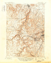
~ Spearfish SD topo map, 1:62500 scale, 15 X 15 Minute, Historical, 1915, updated 1950
Spearfish, South Dakota, USGS topographic map dated 1915.
Includes geographic coordinates (latitude and longitude). This topographic map is suitable for hiking, camping, and exploring, or framing it as a wall map.
Printed on-demand using high resolution imagery, on heavy weight and acid free paper, or alternatively on a variety of synthetic materials.
Topos available on paper, Waterproof, Poly, or Tyvek. Usually shipping rolled, unless combined with other folded maps in one order.
- Product Number: USGS-5608774
- Free digital map download (high-resolution, GeoPDF): Spearfish, South Dakota (file size: 11 MB)
- Map Size: please refer to the dimensions of the GeoPDF map above
- Weight (paper map): ca. 55 grams
- Map Type: POD USGS Topographic Map
- Map Series: HTMC
- Map Verison: Historical
- Cell ID: 62824
- Scan ID: 344644
- Imprint Year: 1950
- Survey Year: 1898
- Datum: Unstated
- Map Projection: Polyconic
- Map published by United States Geological Survey
- Map Language: English
- Scanner Resolution: 600 dpi
- Map Cell Name: Spearfish
- Grid size: 15 X 15 Minute
- Date on map: 1915
- Map Scale: 1:62500
- Geographical region: South Dakota, United States
Neighboring Maps:
All neighboring USGS topo maps are available for sale online at a variety of scales.
Spatial coverage:
Topo map Spearfish, South Dakota, covers the geographical area associated the following places:
- Englewood - Terry - Dacy (historical) - Preston - Flatiron I (historical) - Maurice - Maitland - Lancaster City (historical) - Victoria - Ragged Top (historical) - Woodville - Blacktail - Central City - Terraville - Carbonate (historical) - Savoy - Cheyenne Crossing - Kirk - Cartesville (historical) - Lead - Elmore - Hanna - Gayville - Spearfish - Trojan - Carthage (historical)
- Map Area ID: AREA44.544.25-104-103.75
- Northwest corner Lat/Long code: USGSNW44.5-104
- Northeast corner Lat/Long code: USGSNE44.5-103.75
- Southwest corner Lat/Long code: USGSSW44.25-104
- Southeast corner Lat/Long code: USGSSE44.25-103.75
- Northern map edge Latitude: 44.5
- Southern map edge Latitude: 44.25
- Western map edge Longitude: -104
- Eastern map edge Longitude: -103.75


