
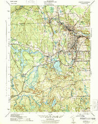
~ Crompton RI topo map, 1:31680 scale, 7.5 X 7.5 Minute, Historical, 1943
Crompton, Rhode Island, USGS topographic map dated 1943.
Includes geographic coordinates (latitude and longitude). This topographic map is suitable for hiking, camping, and exploring, or framing it as a wall map.
Printed on-demand using high resolution imagery, on heavy weight and acid free paper, or alternatively on a variety of synthetic materials.
Topos available on paper, Waterproof, Poly, or Tyvek. Usually shipping rolled, unless combined with other folded maps in one order.
- Product Number: USGS-5604384
- Free digital map download (high-resolution, GeoPDF): Crompton, Rhode Island (file size: 9 MB)
- Map Size: please refer to the dimensions of the GeoPDF map above
- Weight (paper map): ca. 55 grams
- Map Type: POD USGS Topographic Map
- Map Series: HTMC
- Map Verison: Historical
- Cell ID: 69785
- Scan ID: 353409
- Woodland Tint: Yes
- Datum: NAD27
- Map Projection: Polyconic
- Map published by United States Army Corps of Engineers
- Map published by United States Department of War
- Map Language: English
- Scanner Resolution: 600 dpi
- Map Cell Name: Crompton
- Grid size: 7.5 X 7.5 Minute
- Date on map: 1943
- Map Scale: 1:31680
- Geographical region: Rhode Island, United States
Neighboring Maps:
All neighboring USGS topo maps are available for sale online at a variety of scales.
Spatial coverage:
Topo map Crompton, Rhode Island, covers the geographical area associated the following places:
- Colvintown - Fiskeville - Jackson - Clyde - Spencers Corner - Birch Hill (historical) - Arctic - Kitts Corner - Lippitt - West Warwick - Centerville - Anthony - Shippee Corner - Washington - Hope - Arkwright - Ike Shippee Corner - Quidnick - River Point - Crompton - Moosehorn Corner - Phenix - Tarbox Corner - Spring Lake - Harris
- Map Area ID: AREA41.7541.625-71.625-71.5
- Northwest corner Lat/Long code: USGSNW41.75-71.625
- Northeast corner Lat/Long code: USGSNE41.75-71.5
- Southwest corner Lat/Long code: USGSSW41.625-71.625
- Southeast corner Lat/Long code: USGSSE41.625-71.5
- Northern map edge Latitude: 41.75
- Southern map edge Latitude: 41.625
- Western map edge Longitude: -71.625
- Eastern map edge Longitude: -71.5


