
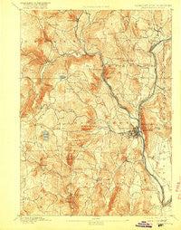
~ Brattleboro VT topo map, 1:62500 scale, 15 X 15 Minute, Historical, 1893, updated 1916
Brattleboro, Vermont, USGS topographic map dated 1893.
Includes geographic coordinates (latitude and longitude). This topographic map is suitable for hiking, camping, and exploring, or framing it as a wall map.
Printed on-demand using high resolution imagery, on heavy weight and acid free paper, or alternatively on a variety of synthetic materials.
Topos available on paper, Waterproof, Poly, or Tyvek. Usually shipping rolled, unless combined with other folded maps in one order.
- Product Number: USGS-5600126
- Free digital map download (high-resolution, GeoPDF): Brattleboro, Vermont (file size: 11 MB)
- Map Size: please refer to the dimensions of the GeoPDF map above
- Weight (paper map): ca. 55 grams
- Map Type: POD USGS Topographic Map
- Map Series: HTMC
- Map Verison: Historical
- Cell ID: 51744
- Scan ID: 337869
- Imprint Year: 1916
- Survey Year: 1889
- Datum: Unstated
- Map Projection: Unstated
- Map published by United States Geological Survey
- Map Language: English
- Scanner Resolution: 600 dpi
- Map Cell Name: Brattleboro
- Grid size: 15 X 15 Minute
- Date on map: 1893
- Map Scale: 1:62500
- Geographical region: Vermont, United States
Neighboring Maps:
All neighboring USGS topo maps are available for sale online at a variety of scales.
Spatial coverage:
Topo map Brattleboro, Vermont, covers the geographical area associated the following places:
- Newfane - Mountain Home Trailer Park - North Hinsdale - Harrisville - Williamsville - Marlboro - Halifax - Green River - Guilford - Putney - West Brattleboro - Dummerston Center - Williamsville Station - Vernon - Algiers (historical) - West Chesterfield - East Dummerston - Grove - Ames Hill - Brattleboro - Reid Hollow - West Guilford - South Newfane - Whitneyville - West Dummerston - North Vernon - Fairview Village - Guilford Center
- Map Area ID: AREA4342.75-72.75-72.5
- Northwest corner Lat/Long code: USGSNW43-72.75
- Northeast corner Lat/Long code: USGSNE43-72.5
- Southwest corner Lat/Long code: USGSSW42.75-72.75
- Southeast corner Lat/Long code: USGSSE42.75-72.5
- Northern map edge Latitude: 43
- Southern map edge Latitude: 42.75
- Western map edge Longitude: -72.75
- Eastern map edge Longitude: -72.5


