
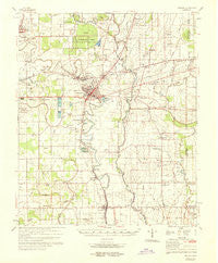
~ Tralake MS topo map, 1:62500 scale, 15 X 15 Minute, Historical, 1969
Tralake, Mississippi, USGS topographic map dated 1969.
Includes geographic coordinates (latitude and longitude). This topographic map is suitable for hiking, camping, and exploring, or framing it as a wall map.
Printed on-demand using high resolution imagery, on heavy weight and acid free paper, or alternatively on a variety of synthetic materials.
Topos available on paper, Waterproof, Poly, or Tyvek. Usually shipping rolled, unless combined with other folded maps in one order.
- Product Number: USGS-5598832
- Free digital map download (high-resolution, GeoPDF): Tralake, Mississippi (file size: 7 MB)
- Map Size: please refer to the dimensions of the GeoPDF map above
- Weight (paper map): ca. 55 grams
- Map Type: POD USGS Topographic Map
- Map Series: HTMC
- Map Verison: Historical
- Cell ID: 63665
- Scan ID: 337123
- Woodland Tint: Yes
- Aerial Photo Year: 1966
- Field Check Year: 1969
- Survey Year: 1967
- Datum: NAD27
- Map Projection: Polyconic
- Map published by United States Army Corps of Engineers
- Map published by United States Department of War
- Map Language: English
- Scanner Resolution: 600 dpi
- Map Cell Name: Tralake
- Grid size: 15 X 15 Minute
- Date on map: 1969
- Map Scale: 1:62500
- Geographical region: Mississippi, United States
Neighboring Maps:
All neighboring USGS topo maps are available for sale online at a variety of scales.
Spatial coverage:
Topo map Tralake, Mississippi, covers the geographical area associated the following places:
- Nelia (historical) - Aldridge - Hays - McGrath - Rexburg - Geneill - Stoneville - Heads - Wilmot - Tribbett - Long - Dunleith - Quay (historical) - Osseola - Elizabeth - Almy - Bourbon - Randolph (historical) - Isenberg - Manhattan - Holly Ridge - Leland - Jones Chapel - Tamburo (historical) - Hollyknowe - Tralake - Johnston - Ingrams - Magenta - Dunkirk - Arcola - Cold Springs (historical) - Burdette - New Town - Ashley Crossing
- Map Area ID: AREA33.533.25-91-90.75
- Northwest corner Lat/Long code: USGSNW33.5-91
- Northeast corner Lat/Long code: USGSNE33.5-90.75
- Southwest corner Lat/Long code: USGSSW33.25-91
- Southeast corner Lat/Long code: USGSSE33.25-90.75
- Northern map edge Latitude: 33.5
- Southern map edge Latitude: 33.25
- Western map edge Longitude: -91
- Eastern map edge Longitude: -90.75


