
~ Spanish Fort LA topo map, 1:62500 scale, 15 X 15 Minute, Historical, 1891, updated 1917
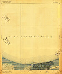
Spanish Fort, Louisiana, USGS topographic map dated 1891.
Includes geographic coordinates (latitude and longitude). This topographic map is suitable for hiking, camping, and exploring, or framing it as a wall map.
Printed on-demand using high resolution imagery, on heavy weight and acid free paper, or alternatively on a variety of synthetic materials.
Topos available on paper, Waterproof, Poly, or Tyvek. Usually shipping rolled, unless combined with other folded maps in one order.
- Product Number: USGS-5594836
- Free digital map download (high-resolution, GeoPDF): Spanish Fort, Louisiana (file size: 5 MB)
- Map Size: please refer to the dimensions of the GeoPDF map above
- Weight (paper map): ca. 55 grams
- Map Type: POD USGS Topographic Map
- Map Series: HTMC
- Map Verison: Historical
- Cell ID: 62812
- Scan ID: 335019
- Imprint Year: 1917
- Survey Year: 1890
- Datum: Unstated
- Map Projection: Unstated
- Map published by United States Geological Survey
- Map Language: English
- Scanner Resolution: 600 dpi
- Map Cell Name: Spanish Fort
- Grid size: 15 X 15 Minute
- Date on map: 1891
- Map Scale: 1:62500
- Geographical region: Louisiana, United States
Neighboring Maps:
All neighboring USGS topo maps are available for sale online at a variety of scales.
Spatial coverage:
Topo map Spanish Fort, Louisiana, covers the geographical area associated the following places:
- Milneburg - Spanish Fort - Lakeview - Pontchartrain Shores - West Lake - Camp Leroy Johnson - Seabrook - Pine Village - Lake Terrace - Westgate - Pontchartrain Gardens - Milneburg (historical) - Gentilly Woods - Seabrook - Willowdale - Gentilly - Bissonet Plaza - Lakeshore East - Bucktown - Pontchartrain Beach - Gentilly Terrace - Flamingo Recreational Vehicle and Mobile Home Park - Lakeshore West - Indian Beach - West End - Lake Oaks
- Map Area ID: AREA30.2530-90.25-90
- Northwest corner Lat/Long code: USGSNW30.25-90.25
- Northeast corner Lat/Long code: USGSNE30.25-90
- Southwest corner Lat/Long code: USGSSW30-90.25
- Southeast corner Lat/Long code: USGSSE30-90
- Northern map edge Latitude: 30.25
- Southern map edge Latitude: 30
- Western map edge Longitude: -90.25
- Eastern map edge Longitude: -90


