
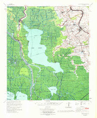
~ Napoleonville LA topo map, 1:62500 scale, 15 X 15 Minute, Historical, 1967, updated 1969
Napoleonville, Louisiana, USGS topographic map dated 1967.
Includes geographic coordinates (latitude and longitude). This topographic map is suitable for hiking, camping, and exploring, or framing it as a wall map.
Printed on-demand using high resolution imagery, on heavy weight and acid free paper, or alternatively on a variety of synthetic materials.
Topos available on paper, Waterproof, Poly, or Tyvek. Usually shipping rolled, unless combined with other folded maps in one order.
- Product Number: USGS-5594548
- Free digital map download (high-resolution, GeoPDF): Napoleonville, Louisiana (file size: 10 MB)
- Map Size: please refer to the dimensions of the GeoPDF map above
- Weight (paper map): ca. 55 grams
- Map Type: POD USGS Topographic Map
- Map Series: HTMC
- Map Verison: Historical
- Cell ID: 58270
- Scan ID: 334852
- Imprint Year: 1969
- Woodland Tint: Yes
- Aerial Photo Year: 1963
- Survey Year: 1966
- Datum: NAD27
- Map Projection: Polyconic
- Map published by United States Geological Survey
- Map published by United States Army Corps of Engineers
- Map Language: English
- Scanner Resolution: 600 dpi
- Map Cell Name: Napoleonville
- Grid size: 15 X 15 Minute
- Date on map: 1967
- Map Scale: 1:62500
- Geographical region: Louisiana, United States
Neighboring Maps:
All neighboring USGS topo maps are available for sale online at a variety of scales.
Spatial coverage:
Topo map Napoleonville, Louisiana, covers the geographical area associated the following places:
- Saint Thomas - Cancienne - Elm Hall - Oakley - Upper Texas - Munsons - Belle River - Wildwood - Percle - Dwight Fields - Stephenville - Pierre Part - Foley - Plaincourtville - Attakapas Landing - Paincourtville - Ratliff - Attakapas Canal - Bayou Geneve - Plattenville - Bayou Crab - Bellewood - Lower Texas - Enola - Brusle Saint Vincent - Glenwood - Little Texas - Elm Hall Junction - Church Spur - Westfield - Napoleonville
- Map Area ID: AREA3029.75-91.25-91
- Northwest corner Lat/Long code: USGSNW30-91.25
- Northeast corner Lat/Long code: USGSNE30-91
- Southwest corner Lat/Long code: USGSSW29.75-91.25
- Southeast corner Lat/Long code: USGSSE29.75-91
- Northern map edge Latitude: 30
- Southern map edge Latitude: 29.75
- Western map edge Longitude: -91.25
- Eastern map edge Longitude: -91


