
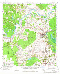
~ Marksville LA topo map, 1:62500 scale, 15 X 15 Minute, Historical, 1962, updated 1967
Marksville, Louisiana, USGS topographic map dated 1962.
Includes geographic coordinates (latitude and longitude). This topographic map is suitable for hiking, camping, and exploring, or framing it as a wall map.
Printed on-demand using high resolution imagery, on heavy weight and acid free paper, or alternatively on a variety of synthetic materials.
Topos available on paper, Waterproof, Poly, or Tyvek. Usually shipping rolled, unless combined with other folded maps in one order.
- Product Number: USGS-5594456
- Free digital map download (high-resolution, GeoPDF): Marksville, Louisiana (file size: 8 MB)
- Map Size: please refer to the dimensions of the GeoPDF map above
- Weight (paper map): ca. 55 grams
- Map Type: POD USGS Topographic Map
- Map Series: HTMC
- Map Verison: Historical
- Cell ID: 57180
- Scan ID: 334794
- Imprint Year: 1967
- Woodland Tint: Yes
- Aerial Photo Year: 1957
- Survey Year: 1962
- Datum: NAD27
- Map Projection: Polyconic
- Map published by United States Geological Survey
- Map Language: English
- Scanner Resolution: 600 dpi
- Map Cell Name: Marksville
- Grid size: 15 X 15 Minute
- Date on map: 1962
- Map Scale: 1:62500
- Geographical region: Louisiana, United States
Neighboring Maps:
All neighboring USGS topo maps are available for sale online at a variety of scales.
Spatial coverage:
Topo map Marksville, Louisiana, covers the geographical area associated the following places:
- Bijou - Moncla - Mansura - Long Bridge - Spring Bayou Landing - Belleville - Fifth Ward - Dunlap - Center Point - Echo - Norma - Oklahoma - Nicks (historical) - Pinegrove (historical) - Cocoville - Ruby - Marksville - Vick - Belle d'Eau - Hessmer - Montcla - Brouillette - Egg Bend - Reynolds - Cassandra - Effie
- Map Area ID: AREA31.2531-92.25-92
- Northwest corner Lat/Long code: USGSNW31.25-92.25
- Northeast corner Lat/Long code: USGSNE31.25-92
- Southwest corner Lat/Long code: USGSSW31-92.25
- Southeast corner Lat/Long code: USGSSE31-92
- Northern map edge Latitude: 31.25
- Southern map edge Latitude: 31
- Western map edge Longitude: -92.25
- Eastern map edge Longitude: -92


