
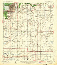
~ Lake Charles LA topo map, 1:62500 scale, 15 X 15 Minute, Historical, 1942
Lake Charles, Louisiana, USGS topographic map dated 1942.
Includes geographic coordinates (latitude and longitude). This topographic map is suitable for hiking, camping, and exploring, or framing it as a wall map.
Printed on-demand using high resolution imagery, on heavy weight and acid free paper, or alternatively on a variety of synthetic materials.
Topos available on paper, Waterproof, Poly, or Tyvek. Usually shipping rolled, unless combined with other folded maps in one order.
- Product Number: USGS-5594318
- Free digital map download (high-resolution, GeoPDF): Lake Charles, Louisiana (file size: 6 MB)
- Map Size: please refer to the dimensions of the GeoPDF map above
- Weight (paper map): ca. 55 grams
- Map Type: POD USGS Topographic Map
- Map Series: HTMC
- Map Verison: Historical
- Cell ID: 56427
- Scan ID: 334720
- Woodland Tint: Yes
- Survey Year: 1940
- Datum: NAD27
- Map Projection: Polyconic
- Map published by United States Geological Survey
- Map Language: English
- Scanner Resolution: 600 dpi
- Map Cell Name: Lake Charles
- Grid size: 15 X 15 Minute
- Date on map: 1942
- Map Scale: 1:62500
- Geographical region: Louisiana, United States
Neighboring Maps:
All neighboring USGS topo maps are available for sale online at a variety of scales.
Spatial coverage:
Topo map Lake Charles, Louisiana, covers the geographical area associated the following places:
- Crestwood Community Mobile Home Park - Quail Ridge Mobile Home Park - Interstate 10 Mobile Village - Oak Hurst Mobile Home Park - Iowa - Pine Acres Trailer Park - Gulf Stream Manor Mobile Home Park - Bellevue - Lake Charles - Chalkley - Harbor - Manchester - Fairview Recreational Mobile Estates - Chardele Mobile Estates - Prairieland - James Mobile Home Park - Greinwich Village - Hipple - Chloe - Tommasi Mobile Village - Hacketts Corner - Holmwood - University Place - Herbert Trailer Park - Chennault Mobile Village - Bon Air - Ben's Mobile Home Park - Mallard Junction - Sugarloaf Community Mobile Home Park
- Map Area ID: AREA30.2530-93.25-93
- Northwest corner Lat/Long code: USGSNW30.25-93.25
- Northeast corner Lat/Long code: USGSNE30.25-93
- Southwest corner Lat/Long code: USGSSW30-93.25
- Southeast corner Lat/Long code: USGSSE30-93
- Northern map edge Latitude: 30.25
- Southern map edge Latitude: 30
- Western map edge Longitude: -93.25
- Eastern map edge Longitude: -93


