
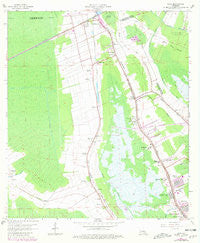
~ Gray LA topo map, 1:24000 scale, 7.5 X 7.5 Minute, Historical, 1963, updated 1981
Gray, Louisiana, USGS topographic map dated 1963.
Includes geographic coordinates (latitude and longitude). This topographic map is suitable for hiking, camping, and exploring, or framing it as a wall map.
Printed on-demand using high resolution imagery, on heavy weight and acid free paper, or alternatively on a variety of synthetic materials.
Topos available on paper, Waterproof, Poly, or Tyvek. Usually shipping rolled, unless combined with other folded maps in one order.
- Product Number: USGS-5589710
- Free digital map download (high-resolution, GeoPDF): Gray, Louisiana (file size: 9 MB)
- Map Size: please refer to the dimensions of the GeoPDF map above
- Weight (paper map): ca. 55 grams
- Map Type: POD USGS Topographic Map
- Map Series: HTMC
- Map Verison: Historical
- Cell ID: 18228
- Scan ID: 332141
- Imprint Year: 1981
- Woodland Tint: Yes
- Photo Revision Year: 1980
- Aerial Photo Year: 1978
- Edit Year: 1980
- Survey Year: 1963
- Datum: NAD27
- Map Projection: Polyconic
- Map published by United States Geological Survey
- Map Language: English
- Scanner Resolution: 600 dpi
- Map Cell Name: Gray
- Grid size: 7.5 X 7.5 Minute
- Date on map: 1963
- Map Scale: 1:24000
- Geographical region: Louisiana, United States
Neighboring Maps:
All neighboring USGS topo maps are available for sale online at a variety of scales.
Spatial coverage:
Topo map Gray, Louisiana, covers the geographical area associated the following places:
- Ellendale - Mobile Estates Mobile Home Park - Allemand - Country Boy Mobile Home Park - Edward Daigle - Oakshire Manor - Minerva Plantation - Idlewild - Highland Park - Cypress Gardens - Country Hollow - Ellsworth - Magnolia - Gray - Central - Lazy Acres - Magnolia Plantation - Country Boy Mobile Home Park - Schriever - McBride - Ardoyne - Fairlane - Bull Run - Isle of Cuba - Rebecca Plantation - Lost Bayou Mobile Home Park
- Map Area ID: AREA29.7529.625-90.875-90.75
- Northwest corner Lat/Long code: USGSNW29.75-90.875
- Northeast corner Lat/Long code: USGSNE29.75-90.75
- Southwest corner Lat/Long code: USGSSW29.625-90.875
- Southeast corner Lat/Long code: USGSSE29.625-90.75
- Northern map edge Latitude: 29.75
- Southern map edge Latitude: 29.625
- Western map edge Longitude: -90.875
- Eastern map edge Longitude: -90.75


