
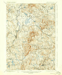
~ Peterboro NH topo map, 1:62500 scale, 15 X 15 Minute, Historical, 1900, updated 1937
Peterboro, New Hampshire, USGS topographic map dated 1900.
Includes geographic coordinates (latitude and longitude). This topographic map is suitable for hiking, camping, and exploring, or framing it as a wall map.
Printed on-demand using high resolution imagery, on heavy weight and acid free paper, or alternatively on a variety of synthetic materials.
Topos available on paper, Waterproof, Poly, or Tyvek. Usually shipping rolled, unless combined with other folded maps in one order.
- Product Number: USGS-5583782
- Free digital map download (high-resolution, GeoPDF): Peterboro, New Hampshire (file size: 10 MB)
- Map Size: please refer to the dimensions of the GeoPDF map above
- Weight (paper map): ca. 55 grams
- Map Type: POD USGS Topographic Map
- Map Series: HTMC
- Map Verison: Historical
- Cell ID: 60898
- Scan ID: 330302
- Imprint Year: 1937
- Survey Year: 1897
- Datum: NAD
- Map Projection: Polyconic
- Map published by United States Geological Survey
- Map Language: English
- Scanner Resolution: 600 dpi
- Map Cell Name: Peterborough
- Grid size: 15 X 15 Minute
- Date on map: 1900
- Map Scale: 1:62500
- Geographical region: New Hampshire, United States
Neighboring Maps:
All neighboring USGS topo maps are available for sale online at a variety of scales.
Spatial coverage:
Topo map Peterboro, New Hampshire, covers the geographical area associated the following places:
- Sharon - North Village - Elmwood - Squantum - Francestown - Davis - West Peterborough - Russell - Greenville - Greenfield - Lyndeborough - Bank - New Ipswich Center - Noone - Happy Valley - MacDowell Colony - Temple - Pratt - Hadley - South Lyndeborough - Wilder - West Wilton - Davisville - High Bridge - Drury - Wilton Center - Hancock - Peterborough
- Map Area ID: AREA4342.75-72-71.75
- Northwest corner Lat/Long code: USGSNW43-72
- Northeast corner Lat/Long code: USGSNE43-71.75
- Southwest corner Lat/Long code: USGSSW42.75-72
- Southeast corner Lat/Long code: USGSSE42.75-71.75
- Northern map edge Latitude: 43
- Southern map edge Latitude: 42.75
- Western map edge Longitude: -72
- Eastern map edge Longitude: -71.75


