
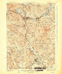
~ Penacook NH topo map, 1:62500 scale, 15 X 15 Minute, Historical, 1927
Penacook, New Hampshire, USGS topographic map dated 1927.
Includes geographic coordinates (latitude and longitude). This topographic map is suitable for hiking, camping, and exploring, or framing it as a wall map.
Printed on-demand using high resolution imagery, on heavy weight and acid free paper, or alternatively on a variety of synthetic materials.
Topos available on paper, Waterproof, Poly, or Tyvek. Usually shipping rolled, unless combined with other folded maps in one order.
- Product Number: USGS-5583758
- Free digital map download (high-resolution, GeoPDF): Penacook, New Hampshire (file size: 11 MB)
- Map Size: please refer to the dimensions of the GeoPDF map above
- Weight (paper map): ca. 55 grams
- Map Type: POD USGS Topographic Map
- Map Series: HTMC
- Map Verison: Historical
- Cell ID: 60862
- Scan ID: 330292
- Visual Version Number: 1
- Survey Year: 1925
- Datum: NAD
- Map Projection: Polyconic
- Map published by United States Geological Survey
- Map Language: English
- Scanner Resolution: 600 dpi
- Map Cell Name: Penacook
- Grid size: 15 X 15 Minute
- Date on map: 1927
- Map Scale: 1:62500
- Geographical region: New Hampshire, United States
Neighboring Maps:
All neighboring USGS topo maps are available for sale online at a variety of scales.
Spatial coverage:
Topo map Penacook, New Hampshire, covers the geographical area associated the following places:
- Sanbornton - West Franklin - East Tilton - Webster Lake - Thompson Corner - Dingit Corner - Gerrish Corner - Kezer Seminary - Franklin - Shaw Corner (historical) - Boscawen - Boyce - Webster Place - Canterbury Station - Salisbury - Snyders Hill - Penacook - Gardners Grove - Salisbury Heights - Tilton - East Andover - Canterbury - Lochmere - Davisville - Swetts Mills - The Plains - Webster - Concord Manor - Northfield - Gerrish
- Map Area ID: AREA43.543.25-71.75-71.5
- Northwest corner Lat/Long code: USGSNW43.5-71.75
- Northeast corner Lat/Long code: USGSNE43.5-71.5
- Southwest corner Lat/Long code: USGSSW43.25-71.75
- Southeast corner Lat/Long code: USGSSE43.25-71.5
- Northern map edge Latitude: 43.5
- Southern map edge Latitude: 43.25
- Western map edge Longitude: -71.75
- Eastern map edge Longitude: -71.5


