
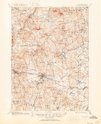
~ Milford NH topo map, 1:62500 scale, 15 X 15 Minute, Historical, 1906, updated 1950
Milford, New Hampshire, USGS topographic map dated 1906.
Includes geographic coordinates (latitude and longitude). This topographic map is suitable for hiking, camping, and exploring, or framing it as a wall map.
Printed on-demand using high resolution imagery, on heavy weight and acid free paper, or alternatively on a variety of synthetic materials.
Topos available on paper, Waterproof, Poly, or Tyvek. Usually shipping rolled, unless combined with other folded maps in one order.
- Product Number: USGS-5583518
- Free digital map download (high-resolution, GeoPDF): Milford, New Hampshire (file size: 10 MB)
- Map Size: please refer to the dimensions of the GeoPDF map above
- Weight (paper map): ca. 55 grams
- Map Type: POD USGS Topographic Map
- Map Series: HTMC
- Map Verison: Historical
- Cell ID: 57638
- Scan ID: 330160
- Imprint Year: 1950
- Survey Year: 1904
- Datum: NAD
- Map Projection: Polyconic
- Map published by United States Geological Survey
- Map Language: English
- Scanner Resolution: 600 dpi
- Map Cell Name: Milford
- Grid size: 15 X 15 Minute
- Date on map: 1906
- Map Scale: 1:62500
- Geographical region: New Hampshire, United States
Neighboring Maps:
All neighboring USGS topo maps are available for sale online at a variety of scales.
Spatial coverage:
Topo map Milford, New Hampshire, covers the geographical area associated the following places:
- Broad Acres - Cricket Corner - New Boston - North Brookline - Browns Corner - East Milford - Milford - South Milford - Richardson (historical) - Wilton - Amherst - Perham Corner - Lincoln Park - Johnson Corner - Blood (historical) - Mont Vernon - Mountain Base - Klondike Corner - Ponemah - Bedford - Lawrence Corner - Field and Stream Travel Trailer Park - Pinardville - Woodland Park - South Merrimack - Curtis Corner
- Map Area ID: AREA4342.75-71.75-71.5
- Northwest corner Lat/Long code: USGSNW43-71.75
- Northeast corner Lat/Long code: USGSNE43-71.5
- Southwest corner Lat/Long code: USGSSW42.75-71.75
- Southeast corner Lat/Long code: USGSSE42.75-71.5
- Northern map edge Latitude: 43
- Southern map edge Latitude: 42.75
- Western map edge Longitude: -71.75
- Eastern map edge Longitude: -71.5


