
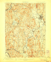
~ Keene NH topo map, 1:62500 scale, 15 X 15 Minute, Historical, 1898, updated 1906
Keene, New Hampshire, USGS topographic map dated 1898.
Includes geographic coordinates (latitude and longitude). This topographic map is suitable for hiking, camping, and exploring, or framing it as a wall map.
Printed on-demand using high resolution imagery, on heavy weight and acid free paper, or alternatively on a variety of synthetic materials.
Topos available on paper, Waterproof, Poly, or Tyvek. Usually shipping rolled, unless combined with other folded maps in one order.
- Product Number: USGS-5583436
- Free digital map download (high-resolution, GeoPDF): Keene, New Hampshire (file size: 11 MB)
- Map Size: please refer to the dimensions of the GeoPDF map above
- Weight (paper map): ca. 55 grams
- Map Type: POD USGS Topographic Map
- Map Series: HTMC
- Map Verison: Historical
- Cell ID: 56046
- Scan ID: 330110
- Imprint Year: 1906
- Survey Year: 1895
- Datum: Unstated
- Map Projection: Unstated
- Map published by United States Geological Survey
- Map Language: English
- Scanner Resolution: 600 dpi
- Map Cell Name: Keene
- Grid size: 15 X 15 Minute
- Date on map: 1898
- Map Scale: 1:62500
- Geographical region: New Hampshire, United States
Neighboring Maps:
All neighboring USGS topo maps are available for sale online at a variety of scales.
Spatial coverage:
Topo map Keene, New Hampshire, covers the geographical area associated the following places:
- Hillside Acres Mobile Home Park - Swanzey - Richmond - East Putney - Scotland - Tanglewood Estates - Westmoreland - Gilboa - Maple Acres - Joslin - Camp Notre Dame - Ashuelot - Swanzey Station - Westport - Poocham - Spofford - Chesterfield - Camp Forest Lake - Winchester - Hinsdale - Longmeadow Subdivision - East Swanzey - North Richmond - Keene - North Swanzey - East Westmoreland - Dole Junction - Harper Acres - West Swanzey - Spragueville
- Map Area ID: AREA4342.75-72.5-72.25
- Northwest corner Lat/Long code: USGSNW43-72.5
- Northeast corner Lat/Long code: USGSNE43-72.25
- Southwest corner Lat/Long code: USGSSW42.75-72.5
- Southeast corner Lat/Long code: USGSSE42.75-72.25
- Northern map edge Latitude: 43
- Southern map edge Latitude: 42.75
- Western map edge Longitude: -72.5
- Eastern map edge Longitude: -72.25


