
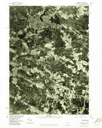
~ Exeter NH topo map, 1:25000 scale, 7.5 X 7.5 Minute, Historical, 1977, updated 1981
Exeter, New Hampshire, USGS topographic map dated 1977.
Includes geographic coordinates (latitude and longitude). This topographic map is suitable for hiking, camping, and exploring, or framing it as a wall map.
Printed on-demand using high resolution imagery, on heavy weight and acid free paper, or alternatively on a variety of synthetic materials.
Topos available on paper, Waterproof, Poly, or Tyvek. Usually shipping rolled, unless combined with other folded maps in one order.
- Product Number: USGS-5583048
- Free digital map download (high-resolution, GeoPDF): Exeter, New Hampshire (file size: 13 MB)
- Map Size: please refer to the dimensions of the GeoPDF map above
- Weight (paper map): ca. 55 grams
- Map Type: POD USGS Topographic Map
- Map Series: HTMC
- Map Verison: Historical
- Cell ID: 14739
- Scan ID: 329892
- Imprint Year: 1981
- Aerial Photo Year: 1977
- Datum: NAD27
- Map Projection: Transverse Mercator
- Orthophoto: Quad
- Map published by United States Geological Survey
- Keywords: Nonstandard Press Run
- Map Language: English
- Scanner Resolution: 600 dpi
- Map Cell Name: Exeter
- Grid size: 7.5 X 7.5 Minute
- Date on map: 1977
- Map Scale: 1:25000
- Geographical region: New Hampshire, United States
Neighboring Maps:
All neighboring USGS topo maps are available for sale online at a variety of scales.
Spatial coverage:
Topo map Exeter, New Hampshire, covers the geographical area associated the following places:
- Lamprey Corners - Perkins Hill - Eastman Corners - Weares Mill - Parkman Corner - Monahan Corners - Tappan Corners - South Hampton - Weare Corner - Smith Corner - Jady Hill - Phillips Park - Towles Corner - Sanborn Corners - Sanborn - Nason Corners - Haynes Corner - Five Corners - Fogg Corners - Gooch Corner - Coffins Mill - Blacksnake Trailer Park - Exeter - Dows Corner - Prescott Corner - Brick School Corner - Austin Corners - Kensington
- Map Area ID: AREA4342.875-71-70.875
- Northwest corner Lat/Long code: USGSNW43-71
- Northeast corner Lat/Long code: USGSNE43-70.875
- Southwest corner Lat/Long code: USGSSW42.875-71
- Southeast corner Lat/Long code: USGSSE42.875-70.875
- Northern map edge Latitude: 43
- Southern map edge Latitude: 42.875
- Western map edge Longitude: -71
- Eastern map edge Longitude: -70.875


