
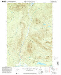
~ Percy Peaks NH topo map, 1:24000 scale, 7.5 X 7.5 Minute, Historical, 1996, updated 2000
Percy Peaks, New Hampshire, USGS topographic map dated 1996.
Includes geographic coordinates (latitude and longitude). This topographic map is suitable for hiking, camping, and exploring, or framing it as a wall map.
Printed on-demand using high resolution imagery, on heavy weight and acid free paper, or alternatively on a variety of synthetic materials.
Topos available on paper, Waterproof, Poly, or Tyvek. Usually shipping rolled, unless combined with other folded maps in one order.
- Product Number: USGS-5582774
- Free digital map download (high-resolution, GeoPDF): Percy Peaks, New Hampshire (file size: 15 MB)
- Map Size: please refer to the dimensions of the GeoPDF map above
- Weight (paper map): ca. 55 grams
- Map Type: POD USGS Topographic Map
- Map Series: HTMC
- Map Verison: Historical
- Cell ID: 34780
- Scan ID: 329744
- Imprint Year: 2000
- Woodland Tint: Yes
- Aerial Photo Year: 1993
- Edit Year: 1996
- Datum: NAD27
- Map Projection: Transverse Mercator
- Map published by United States Geological Survey
- Map published by United States Forest Service
- Map Language: English
- Scanner Resolution: 600 dpi
- Map Cell Name: Percy Peaks
- Grid size: 7.5 X 7.5 Minute
- Date on map: 1996
- Map Scale: 1:24000
- Geographical region: New Hampshire, United States
Neighboring Maps:
All neighboring USGS topo maps are available for sale online at a variety of scales.
Spatial coverage:
Topo map Percy Peaks, New Hampshire, covers the geographical area associated the following places:
- Doctor George S Emerson Elementary School - Potters Ledge - Jimmy Cole Brook - Bald Mountain - Little Bog Pond - Little Bog Pond Dam - Sugarloaf - East Branch Nash Stream - Long Mountain Pond - Bag Hill - South Percy Peak - Township of Odell - Silver Brook - Christine Lake - Stratford Mountain - Long Mountain Brook - Victor Head - Jimmy Cole Ledge - Pond Brook - Boman Valley - North Percy Peak - Slide Brook - Waterhole Brook - Long Mountain - Roaring Brook - Sugarloaf Pond - Percy Peaks - Whitcomb Pond - Nash Stream
- Map Area ID: AREA44.7544.625-71.5-71.375
- Northwest corner Lat/Long code: USGSNW44.75-71.5
- Northeast corner Lat/Long code: USGSNE44.75-71.375
- Southwest corner Lat/Long code: USGSSW44.625-71.5
- Southeast corner Lat/Long code: USGSSE44.625-71.375
- Northern map edge Latitude: 44.75
- Southern map edge Latitude: 44.625
- Western map edge Longitude: -71.5
- Eastern map edge Longitude: -71.375


